Area Overview for Danesborough & Walton Ward
Photos of Danesborough & Walton Ward

Area Information
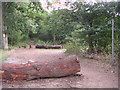
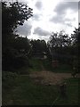
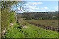
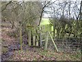
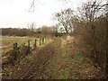
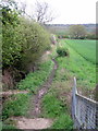
Living in Danesborough & Walton Ward offers a suburban experience within the unitary authority of Milton Keynes. The ward encompasses the civil parish of Walton and includes residential districts such as Browns Wood, Caldecotte, Old Farm Park, Tilbrook, Towergate, Walton, Walton Hall, Walton Park, Walnut Tree, and Wavendon Gate. You will find yourself approximately four miles south of Central Milton Keynes, situated just east of Simpson. The area covers a total size of 21.8 square kilometres. Your daily life revolves around a mix of modern residential zones and employment areas like Tilbrook. Strategic roads including the H9 Groveway, V10 Brickhill Street, and Bletcham Way provide key access points. The River Ouzel forms a natural boundary to the south of the ward. Geographically, the area sits near coordinates around 52.0166°N 0.7002°W, placing it close to significant infrastructure. You will encounter distinct neighbourhood planning initiatives, such as those for the Walton Neighbourhood Plan, which guide cohesive growth up to 2026. Key landmarks include the historic Walton Hall manor house and the deconsecrated chapel of St Michael, which now sits within the Open University campus grounds. Caldecotte Lake extends across the borough boundary, linking Caldecotte and Walton Park into a larger green corridor. This ward represents a blend of established communities and new developments like Bergamot Gardens and the proposed Caldecotte Site C.
- Area Type
- District Borough Unitary Ward
- Area Size
- 21.8 km²
- Population
- 3071
- Population Density
- 141 people/km²
Demographics
The community in Danesborough & Walton Ward presents an older age profile compared to many suburban areas. The median age here is 70, and the most common age range recorded is listed simply as Age: Total, indicating a significant concentration of senior residents. Nearly two-thirds of households, specifically 68%, are owner-occupied, suggesting a population with strong roots or those who have purchased homes over time. The ward recorded a total population of 3 071 for its specific electoral boundaries, though the wider civil parish of Walton includes representation from over 14 000 residents across Milton Keynes City Council. The demographic data does not specify predominant ethnic groups or religious affiliations, so the community appears diverse but without a single dominant cultural identifier visible in the core figures. There is no available breakdown for household composition types beyond the total category, meaning you cannot isolate the number of single-person households versus families with children. This data profile points to an area that caters well to retirees and established families rather than recent young professionals moving in en masse. The age structure influences local services, likely creating a demand for facilities suited to older adults within the civil parish districts that make up this ward.
Household Size
Accommodation Type
Tenure
Ethnic Group
Religion
Household Composition
Age
Household Deprivation
NS-SEC
Explore more demographic insights in this area
Go to Demographics tabPlanning
Planning Constraints
- Flood RiskPremium
- Ramsar Wetland SitesPremium
- Area of Outstanding Natural BeautyPremium
- Protected Nature ReservePremium
- Protected WoodlandPremium