Area Overview for DA9 9QU
Photos of DA9 9QU
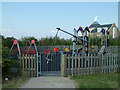

69 photos from this area
Area Information
Key information about the DA9 9QU including its size, population, and administrative classification.
- Area Type
- Postcode
- Area Size
- 1.4 hectares
- Population
- 2648
- Population Density
- 6155 people/km²
House Prices in DA9 9QU
17
Properties
£405,318
Average Sold Price
£150,000
Lowest Price
£640,000
Highest Price
Showing 17 properties
| Address | Type | Beds | Baths | Last Sale Price | Last Sale Date | |
|---|---|---|---|---|---|---|
| 17 Woodland Way, Greenhithe, DA9 9QU | Detached | 4 | 3 | £640,000 | Sep 2022 | |
| 10 Woodland Way, Greenhithe, DA9 9QU | Retail | 4 | 2 | £610,000 | Jul 2022 | |
| 12 Woodland Way, Greenhithe, DA9 9QU | house | 4 | 2 | £558,500 | Jul 2020 | |
| 4 Woodland Way, Greenhithe, DA9 9QU | Detached | 4 | 2 | £490,000 | Mar 2016 | |
| 13 Woodland Way, Greenhithe, DA9 9QU | Detached | 4 | 1 | £336,000 | Dec 2013 | |
| 15 Woodland Way, Greenhithe, DA9 9QU | Detached | - | - | £365,000 | Sep 2008 | |
| 11 Woodland Way, Greenhithe, DA9 9QU | Detached | - | - | £385,000 | Jun 2008 | |
| 7 Woodland Way, Greenhithe, DA9 9QU | Detached | - | - | £355,000 | Oct 2007 | |
| 19 Woodland Way, Greenhithe, DA9 9QU | Detached | - | - | £332,000 | Sep 2006 | |
| 3 Woodland Way, Greenhithe, DA9 9QU | Detached | - | - | £237,000 | Jun 2002 |
Page 1 of 2
Energy Efficiency in DA9 9QU
Amenities
Schools
| Rank | School | Type | Entry gender | Ages |
|---|
Explore more schools in this area
Go to Schools tabDemographics
Household Size
Family (3-5 people)
most common
Accommodation Type
Houses
most common
Tenure
66
majority
Ethnic Group
White
most common
Religion
N/A
most common
Household Composition
N/A
most common
Age
47
median
Adults (30-64 years)
most common
Household Deprivation
N/A
with no deprivation
NS-SEC
47
in Lower managerial occupations
Explore more demographic insights in this area
Go to Demographics tabPlanning
Planning Constraints
- Flood RiskPremium
- Ramsar Wetland SitesPremium
- Area of Outstanding Natural BeautyPremium
- Protected Nature ReservePremium
- Protected WoodlandPremium