Area Overview for DA9 9DD
Photos of DA9 9DD

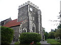
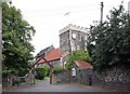
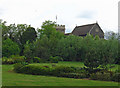
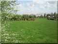
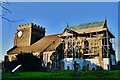
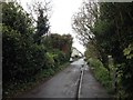
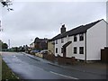
82 photos from this area
Area Information
Key information about the DA9 9DD including its size, population, and administrative classification.
- Area Type
- Postcode
- Area Size
- 1.1 hectares
- Population
- 1548
- Population Density
- 2194 people/km²
House Prices in DA9 9DD
28
Properties
£287,717
Average Sold Price
£69,250
Lowest Price
£715,000
Highest Price
Showing 28 properties
| Address | Type | Beds | Baths | Last Sale Price | Last Sale Date | |
|---|---|---|---|---|---|---|
| 25 Woodward Terrace, Horns Cross, Greenhithe, DA9 9DD | Semi-detached | 3 | 1 | £450,000 | Jul 2023 | |
| 30 Woodward Terrace, Horns Cross, Greenhithe, DA9 9DD | Semi-detached | 3 | 1 | £390,000 | Dec 2022 | |
| 10 Woodward Terrace, Horns Cross, Greenhithe, DA9 9DD | Detached | 5 | 4 | £715,000 | Oct 2022 | |
| 8 Woodward Terrace, Horns Cross, Greenhithe, DA9 9DD | house | - | - | £296,000 | May 2021 | |
| 27 Woodward Terrace, Horns Cross, Greenhithe, DA9 9DD | house | - | - | £390,000 | Nov 2019 | |
| 28 Woodward Terrace, Horns Cross, Greenhithe, DA9 9DD | Semi-detached | 3 | 1 | £268,000 | Jul 2019 | |
| 1 Woodward Terrace, Horns Cross, Greenhithe, DA9 9DD | Semi-detached | 3 | 1 | £320,000 | Jul 2016 | |
| 7 Woodward Terrace, Horns Cross, Greenhithe, DA9 9DD | Semi-detached | 3 | 1 | £280,000 | Mar 2016 | |
| 13 Woodward Terrace, Horns Cross, Greenhithe, DA9 9DD | Semi-detached | 3 | 1 | £240,000 | Feb 2014 | |
| 23 Woodward Terrace, Horns Cross, Greenhithe, DA9 9DD | house | - | - | £250,000 | Jan 2014 |
Page 1 of 3
Energy Efficiency in DA9 9DD
Amenities
Schools
| Rank | School | Type | Entry gender | Ages |
|---|
Explore more schools in this area
Go to Schools tabDemographics
Household Size
Family (3-5 people)
most common
Accommodation Type
Houses
most common
Tenure
66
majority
Ethnic Group
White
most common
Religion
N/A
most common
Household Composition
N/A
most common
Age
47
median
Adults (30-64 years)
most common
Household Deprivation
N/A
with no deprivation
NS-SEC
31
in Lower managerial occupations
Explore more demographic insights in this area
Go to Demographics tabPlanning
Planning Constraints
- Flood RiskPremium
- Ramsar Wetland SitesPremium
- Area of Outstanding Natural BeautyPremium
- Protected Nature ReservePremium
- Protected WoodlandPremium