Area Overview for DA9 9AA
Photos of DA9 9AA
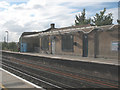
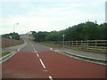
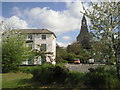
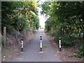


69 photos from this area
Area Information
Key information about the DA9 9AA including its size, population, and administrative classification.
- Area Type
- Postcode
- Area Size
- 6268 m²
- Population
- 1749
- Population Density
- 6743 people/km²
House Prices in DA9 9AA
31
Properties
£206,796
Average Sold Price
£42,250
Lowest Price
£310,000
Highest Price
Showing 31 properties
| Address | Type | Beds | Baths | Last Sale Price | Last Sale Date | |
|---|---|---|---|---|---|---|
| 18 Providence Street, Stone, Greenhithe, DA9 9AA | Terraced | 3 | 1 | £265,500 | Oct 2025 | |
| 17 Providence Street, Stone, Greenhithe, DA9 9AA | Terraced | 3 | 1 | £294,000 | Sep 2025 | |
| 21 Providence Street, Stone, Greenhithe, DA9 9AA | Terraced | 3 | 1 | £300,000 | Oct 2024 | |
| 29A Providence Street, Stone, Greenhithe, DA9 9AA | Flat | 1 | 1 | £145,000 | Jun 2024 | |
| 16 Providence Street, Stone, Greenhithe, DA9 9AA | Terraced | 3 | 1 | £262,000 | Dec 2023 | |
| 22 Providence Street, Stone, Greenhithe, DA9 9AA | Terraced | 3 | 1 | £310,000 | Jun 2022 | |
| 28 Providence Street, Stone, Greenhithe, DA9 9AA | Terraced | 2 | 1 | £305,000 | Nov 2021 | |
| 27 Providence Street, Stone, Greenhithe, DA9 9AA | Terraced | 2 | 2 | £265,000 | Sep 2020 | |
| 9 Providence Street, Stone, Greenhithe, DA9 9AA | Terraced | 2 | 2 | £260,000 | Jun 2019 | |
| 25 Providence Street, Stone, Greenhithe, DA9 9AA | Terraced | 2 | 1 | £233,000 | Jun 2019 |
Page 1 of 4
Energy Efficiency in DA9 9AA
Amenities
Schools
| Rank | School | Type | Entry gender | Ages |
|---|
Explore more schools in this area
Go to Schools tabDemographics
Household Size
Family (3-5 people)
most common
Accommodation Type
Houses
most common
Tenure
66
majority
Ethnic Group
White
most common
Religion
N/A
most common
Household Composition
N/A
most common
Age
47
median
Adults (30-64 years)
most common
Household Deprivation
N/A
with no deprivation
NS-SEC
38
in Lower managerial occupations
Explore more demographic insights in this area
Go to Demographics tabPlanning
Planning Constraints
- Flood RiskPremium
- Ramsar Wetland SitesPremium
- Area of Outstanding Natural BeautyPremium
- Protected Nature ReservePremium
- Protected WoodlandPremium