Area Overview for DA4 9ZW
Photos of DA4 9ZW


Area Information
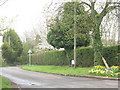
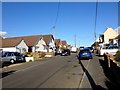
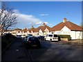
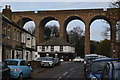
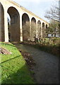
DA4 9ZW is a small, tightly knit postcode area in the River Darent valley, part of the civil parish of Horton Kirby and South Darenth in Kent. With a population of 1,507 and a density of 335 people per square kilometre, it reflects a residential cluster that balances rural charm with proximity to larger towns. The area lies between Sevenoaks and Dartford, with historical roots tracing back to the Norman era and Roman settlements. Daily life here is shaped by its compact size and the surrounding natural and historical features, such as the Grade II-listed Horton Kirby Parish Church and the remnants of a Roman villa. Residents benefit from nearby transport links, including railway stations and motorway access, while the area’s low population density suggests a quieter, more community-focused lifestyle. The postcode’s character is defined by its mix of traditional housing and modern amenities, making it a niche choice for those seeking a peaceful yet connected location.
- Area Type
- Postcode
- Area Size
- Not available
- Population
- 1507
- Population Density
- 335 people/km²
DA4 9ZW is primarily an owner-occupied area, with 78% of homes owned by residents rather than rented. The accommodation type is predominantly houses, which is typical for smaller, rural postcodes. This suggests a market skewed towards private ownership, with fewer rental properties available. The small size of the area means the housing stock is limited, and buyers may need to consider nearby postcodes for more options. The focus on houses rather than flats or apartments indicates a preference for traditional, family-sized homes, which could appeal to those seeking space and privacy. However, the limited supply may mean competition for properties, particularly for those prioritising specific features like garden space or proximity to transport. The area’s compact nature also means that property values are likely influenced by local amenities and historical features, such as the nearby Roman villa site.
House Prices in DA4 9ZW
No properties found in this postcode.
Energy Efficiency in DA4 9ZW
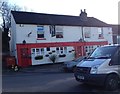
Life in DA4 9ZW is supported by a modest but functional array of amenities. Five retail outlets, including Co-op South, Co-op Lane, and Co-op Longfield, provide essential shopping options. The area’s proximity to three ferry terminals—West Street Pier, Town Pier, and Tilbury Ferry Terminal—offers easy access to water-based travel, though these are more suited to commuters than leisure. The nearby A225 and rail links connect residents to larger towns, while the historical sites, such as the Roman villa remains and the Horton Kirby Environmental Studies Centre, add cultural and educational value. The mix of retail, transport, and historical sites creates a lifestyle that balances practicality with local heritage, appealing to those who prioritise convenience and a connection to the past.
Amenities
Schools
The nearest school to DA4 9ZW is the Horton Kirby Church of England Primary School, which serves the area with a primary education offering. The school has an Ofsted rating of ‘good’, indicating a satisfactory standard of teaching and facilities. As the only school listed in the data, it is the primary educational institution for local children. The absence of secondary schools in the immediate vicinity means families may need to consider nearby postcodes for secondary education. The presence of a ‘good’-rated primary school is a positive factor for families prioritising quality early education, though the lack of a broader school network may be a consideration for those requiring a full range of educational options.
| Rank | School | Type | Entry gender | Ages |
|---|
Explore more schools in this area
Go to Schools tabDemographics
The community in DA4 9ZW is predominantly middle-aged, with a median age of 47 and the most common age range being adults aged 30–64. This suggests a stable population with strong ties to the area. Home ownership is high, at 78%, with houses being the primary type of accommodation. The predominant ethnic group is White, reflecting the area’s traditional demographic profile. The absence of specific data on deprivation or diversity means the community’s socio-economic makeup is not fully detailed, but the high home ownership rate indicates a degree of financial stability. The age profile suggests a population focused on established careers and family life, with fewer young families or retirees compared to other areas. This demographic may influence local services and amenities, which are tailored to the needs of working-age adults and their households.
Household Size
Accommodation Type
Tenure
Ethnic Group
Religion
Household Composition
Age
Household Deprivation
NS-SEC
Explore more demographic insights in this area
Go to Demographics tabPlanning
Planning Constraints
- Flood RiskPremium
- Ramsar Wetland SitesPremium
- Area of Outstanding Natural BeautyPremium
- Protected Nature ReservePremium
- Protected WoodlandPremium