Area Overview for DA4 9LB
Photos of DA4 9LB
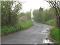
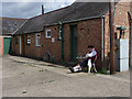
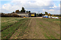
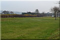
25 photos from this area
Area Information
Key information about the DA4 9LB including its size, population, and administrative classification.
- Area Type
- Postcode
- Area Size
- 73.0 hectares
- Population
- 1464
- Population Density
- 296 people/km²
House Prices in DA4 9LB
18
Properties
£357,500
Average Sold Price
£165,000
Lowest Price
£550,000
Highest Price
Showing 18 properties
| Address | Type | Beds | Baths | Last Sale Price | Last Sale Date | |
|---|---|---|---|---|---|---|
| The Old Farm House, St Margarets Road, Darenth, DA4 9LB | house | - | - | £550,000 | Apr 2011 | |
| The Holt, St Margarets Road, Darenth, DA4 9LB | Bungalow | - | - | £165,000 | Oct 1996 | |
| Newsco Fresh Flowers, St Margarets Farm, St Margarets Road, Darenth, DA4 9LB | warehouse | - | - | - | - | |
| The Loft, St Margarets Farm, St Margarets Road, Darenth, DA4 9LB | office_workshop | - | - | - | - | |
| Commercial Services Trading Ltd, Unit 11, St Margarets Farm, St Margarets Road, Darenth, DA4 9LB | warehouse | - | - | - | - | |
| Caravan 2, St Margarets Farm, St Margarets Road, Darenth, DA4 9LB | office_workshop | - | - | - | - | |
| Caravan 3, St Margarets Farm, St Margarets Road, Darenth, DA4 9LB | office_workshop | - | - | - | - | |
| Caravan 1, St Margarets Farm, St Margarets Road, Darenth, DA4 9LB | Mobile Home | - | - | - | - | |
| 3, St Margarets Cottage, St Margarets Road, Darenth, DA4 9LB | house | - | - | - | - | |
| 1, St Margarets Cottage, St Margarets Road, Darenth, DA4 9LB | Terraced | 2 | 1 | - | - |
Page 1 of 2
Energy Efficiency in DA4 9LB
Amenities
Schools
| Rank | School | Type | Entry gender | Ages |
|---|
Explore more schools in this area
Go to Schools tabDemographics
Household Size
Family (3-5 people)
most common
Accommodation Type
Houses
most common
Tenure
57
majority
Ethnic Group
White
most common
Religion
N/A
most common
Household Composition
N/A
most common
Age
47
median
Adults (30-64 years)
most common
Household Deprivation
N/A
with no deprivation
NS-SEC
27
in Lower managerial occupations
Explore more demographic insights in this area
Go to Demographics tabPlanning
Planning Constraints
- Flood RiskPremium
- Ramsar Wetland SitesPremium
- Area of Outstanding Natural BeautyPremium
- Protected Nature ReservePremium
- Protected WoodlandPremium