Area Overview for DA4 9HU
Photos of DA4 9HU

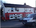
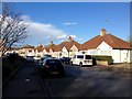
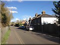

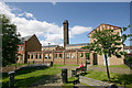

85 photos from this area
Area Information
Key information about the DA4 9HU including its size, population, and administrative classification.
- Area Type
- Postcode
- Area Size
- 8.3 hectares
- Population
- 1157
- Population Density
- 593 people/km²
House Prices in DA4 9HU
12
Properties
£386,429
Average Sold Price
£150,000
Lowest Price
£750,000
Highest Price
Showing 12 properties
| Address | Type | Beds | Baths | Last Sale Price | Last Sale Date | |
|---|---|---|---|---|---|---|
| Wishing Well Cottage, 2 Mallys Place, South Darenth, DA4 9HU | Semi-detached | 3 | - | £360,000 | Apr 2015 | |
| Two Rivers, Mallys Place, South Darenth, DA4 9HU | house | - | - | £440,000 | Dec 2013 | |
| 5 Mallys Place, South Darenth, DA4 9HU | Semi-detached | 3 | 1 | £275,000 | Oct 2009 | |
| Rivendell, Mallys Place, South Darenth, DA4 9HU | Detached | - | - | £515,000 | Dec 2007 | |
| Lakeside Place, Mallys Place, South Darenth, DA4 9HU | Detached | - | - | £750,000 | Dec 2005 | |
| 6 Mallys Place, South Darenth, DA4 9HU | Semi-detached | - | - | £215,000 | Apr 2004 | |
| The Old Mill House, Mallys Place, South Darenth, DA4 9HU | house | - | - | £150,000 | Apr 1997 | |
| 4 Mallys Place, South Darenth, DA4 9HU | Semi-detached | - | - | - | - | |
| Running Blue, Mallys Place, South Darenth, DA4 9HU | Detached | - | - | - | - | |
| The Willows, 3 Mallys Place, South Darenth, DA4 9HU | Semi-detached | - | - | - | - |
Page 1 of 2
Energy Efficiency in DA4 9HU
Amenities
Schools
| Rank | School | Type | Entry gender | Ages |
|---|
Explore more schools in this area
Go to Schools tabDemographics
Household Size
Family (3-5 people)
most common
Accommodation Type
Houses
most common
Tenure
64
majority
Ethnic Group
White
most common
Religion
N/A
most common
Household Composition
N/A
most common
Age
47
median
Adults (30-64 years)
most common
Household Deprivation
N/A
with no deprivation
NS-SEC
34
in Lower managerial occupations
Explore more demographic insights in this area
Go to Demographics tabPlanning
Planning Constraints
- Flood RiskPremium
- Ramsar Wetland SitesPremium
- Area of Outstanding Natural BeautyPremium
- Protected Nature ReservePremium
- Protected WoodlandPremium