Area Overview for DA4 0EB
Photos of DA4 0EB

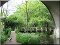


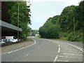


100 photos from this area
Area Information
Key information about the DA4 0EB including its size, population, and administrative classification.
- Area Type
- Postcode
- Area Size
- 31.5 hectares
- Population
- 1458
- Population Density
- 151 people/km²
House Prices in DA4 0EB
18
Properties
£546,000
Average Sold Price
£265,000
Lowest Price
£1,400,000
Highest Price
Showing 18 properties
| Address | Type | Beds | Baths | Last Sale Price | Last Sale Date | |
|---|---|---|---|---|---|---|
| Highwood, Old Dartford Road, Farningham, DA4 0EB | Maisonette | 2 | - | £1,400,000 | Sep 2021 | |
| Kuling, Old Dartford Road, Farningham, DA4 0EB | Chalet | 2 | - | £385,000 | May 2021 | |
| Sunnybank, Old Dartford Road, Farningham, DA4 0EB | Bungalow | 4 | 2 | £445,000 | Feb 2016 | |
| Lucerne, Old Dartford Road, Farningham, DA4 0EB | Bungalow | 3 | - | £330,000 | Apr 2013 | |
| St Marys, Old Dartford Road, Farningham, DA4 0EB | Detached | - | - | £427,500 | Apr 2010 | |
| Brackens, Old Dartford Road, Farningham, DA4 0EB | Detached | - | - | £460,000 | Sep 2009 | |
| Beaushill House, Old Dartford Road, Farningham, DA4 0EB | Detached | - | - | £900,000 | Sep 2007 | |
| Manton Cottage, Old Dartford Road, Farningham, DA4 0EB | Detached | 3 | 2 | £535,000 | Jan 2007 | |
| Allington, Old Dartford Road, Farningham, DA4 0EB | Detached | - | - | £312,500 | Jun 2006 | |
| Rosemount, Old Dartford Road, Farningham, DA4 0EB | Detached | - | - | £265,000 | May 2004 |
Page 1 of 2
Energy Efficiency in DA4 0EB
Amenities
Schools
| Rank | School | Type | Entry gender | Ages |
|---|
Explore more schools in this area
Go to Schools tabDemographics
Household Size
Family (3-5 people)
most common
Accommodation Type
Houses
most common
Tenure
78
majority
Ethnic Group
White
most common
Religion
N/A
most common
Household Composition
N/A
most common
Age
47
median
Adults (30-64 years)
most common
Household Deprivation
N/A
with no deprivation
NS-SEC
44
in Lower managerial occupations
Explore more demographic insights in this area
Go to Demographics tabPlanning
Planning Constraints
- Flood RiskPremium
- Ramsar Wetland SitesPremium
- Area of Outstanding Natural BeautyPremium
- Protected Nature ReservePremium
- Protected WoodlandPremium