Area Overview for DA3 8QN
Photos of DA3 8QN
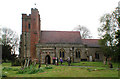
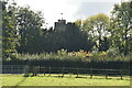
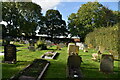
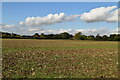
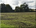
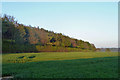
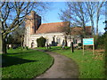

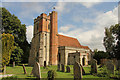
26 photos from this area
Area Information
Key information about the DA3 8QN including its size, population, and administrative classification.
- Area Type
- Postcode
- Area Size
- 6.7 hectares
- Population
- 1306
- Population Density
- 2288 people/km²
House Prices in DA3 8QN
26
Properties
£327,000
Average Sold Price
£139,000
Lowest Price
£560,000
Highest Price
Showing 26 properties
| Address | Type | Beds | Baths | Last Sale Price | Last Sale Date | |
|---|---|---|---|---|---|---|
| 6 Westfield, New Ash Green, DA3 8QN | house | - | - | £560,000 | Feb 2021 | |
| 14 Westfield, New Ash Green, DA3 8QN | Semi-detached | 4 | 1 | £425,000 | Aug 2019 | |
| 23 Westfield, New Ash Green, DA3 8QN | Semi-detached | 3 | 1 | £405,000 | Oct 2018 | |
| 24 Westfield, New Ash Green, DA3 8QN | Semi-detached | 4 | 1 | £512,500 | Aug 2018 | |
| 12 Westfield, New Ash Green, DA3 8QN | Semi-detached | 5 | 2 | £379,995 | Dec 2014 | |
| 17 Westfield, New Ash Green, DA3 8QN | house | - | - | £297,000 | Dec 2013 | |
| 13 Westfield, New Ash Green, DA3 8QN | house | - | - | £309,000 | Nov 2012 | |
| 22 Westfield, New Ash Green, DA3 8QN | house | - | - | £320,000 | Jun 2010 | |
| 3 Westfield, New Ash Green, DA3 8QN | house | - | - | £290,000 | Oct 2009 | |
| 16 Westfield, New Ash Green, DA3 8QN | Detached | - | - | £310,000 | May 2008 |
Page 1 of 3
Energy Efficiency in DA3 8QN
Amenities
Schools
| Rank | School | Type | Entry gender | Ages |
|---|
Explore more schools in this area
Go to Schools tabDemographics
Household Size
Two person
most common
Accommodation Type
Houses
most common
Tenure
94
majority
Ethnic Group
White
most common
Religion
N/A
most common
Household Composition
N/A
most common
Age
47
median
Adults (30-64 years)
most common
Household Deprivation
N/A
with no deprivation
NS-SEC
44
in Lower managerial occupations
Explore more demographic insights in this area
Go to Demographics tabPlanning
Planning Constraints
- Flood RiskPremium
- Ramsar Wetland SitesPremium
- Area of Outstanding Natural BeautyPremium
- Protected Nature ReservePremium
- Protected WoodlandPremium