Area Overview for DA3 7LF
Photos of DA3 7LF
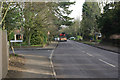
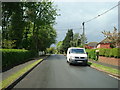
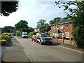
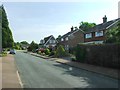
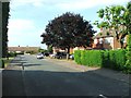
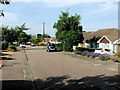
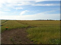
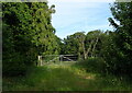
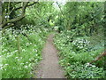
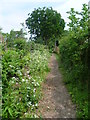
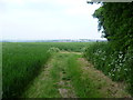
13 photos from this area
Area Information
Key information about the DA3 7LF including its size, population, and administrative classification.
- Area Type
- Postcode
- Area Size
- 2.1 hectares
- Population
- Not available
- Population Density
- Not available
House Prices in DA3 7LF
21
Properties
£665,498
Average Sold Price
£158,000
Lowest Price
£1,050,000
Highest Price
Showing 21 properties
| Address | Type | Beds | Baths | Last Sale Price | Last Sale Date | |
|---|---|---|---|---|---|---|
| 11 Longfield Avenue, Longfield, DA3 7LF | Bungalow | 3 | 2 | £740,000 | Mar 2025 | |
| 1 Longfield Avenue, Longfield, DA3 7LF | Character Property | 6 | 2 | £700,000 | Dec 2024 | |
| 18 Longfield Avenue, Longfield, DA3 7LF | Bungalow | 3 | 2 | £950,000 | Oct 2022 | |
| 14 Longfield Avenue, Longfield, DA3 7LF | Detached | 5 | 2 | £1,050,000 | Nov 2020 | |
| 7 Longfield Avenue, Longfield, DA3 7LF | Bungalow | 3 | 2 | £550,000 | Oct 2019 | |
| 26 Longfield Avenue, Longfield, DA3 7LF | Detached | 5 | 3 | £962,500 | Jul 2019 | |
| 9 Longfield Avenue, Longfield, DA3 7LF | Detached | 4 | 3 | £649,975 | Jul 2015 | |
| 3 Longfield Avenue, Longfield, DA3 7LF | Bungalow | 2 | 1 | £470,000 | Jul 2015 | |
| 8 Longfield Avenue, Longfield, DA3 7LF | Detached | 5 | - | £725,000 | Oct 2010 | |
| 4 Longfield Avenue, Longfield, DA3 7LF | Bungalow | 3 | 2 | £365,000 | Oct 2007 |
Page 1 of 3
Energy Efficiency in DA3 7LF
Amenities
Schools
| Rank | School | Type | Entry gender | Ages |
|---|
Explore more schools in this area
Go to Schools tabDemographics
Household Size
Family (3-5 people)
most common
Accommodation Type
Houses
most common
Tenure
95
majority
Ethnic Group
White
most common
Religion
N/A
most common
Household Composition
N/A
most common
Age
47
median
Adults (30-64 years)
most common
Household Deprivation
N/A
with no deprivation
NS-SEC
48
in Lower managerial occupations
Explore more demographic insights in this area
Go to Demographics tabPlanning
Planning Constraints
- Flood RiskPremium
- Ramsar Wetland SitesPremium
- Area of Outstanding Natural BeautyPremium
- Protected Nature ReservePremium
- Protected WoodlandPremium