Area Overview for DA2 8BQ
Photos of DA2 8BQ
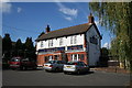
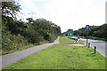
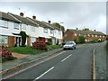
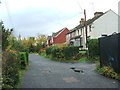


23 photos from this area
Area Information
Key information about the DA2 8BQ including its size, population, and administrative classification.
- Area Type
- Postcode
- Area Size
- 2.2 hectares
- Population
- 1636
- Population Density
- 485 people/km²
House Prices in DA2 8BQ
30
Properties
£256,800
Average Sold Price
£67,000
Lowest Price
£430,000
Highest Price
Showing 30 properties
| Address | Type | Beds | Baths | Last Sale Price | Last Sale Date | |
|---|---|---|---|---|---|---|
| 148 Beacon Drive, Bean, DA2 8BQ | Terraced | 4 | 2 | £430,000 | Mar 2025 | |
| 132 Beacon Drive, Bean, DA2 8BQ | Terraced | 3 | 1 | £370,000 | Feb 2025 | |
| 140 Beacon Drive, Bean, DA2 8BQ | Terraced | 3 | 1 | £355,000 | Nov 2023 | |
| 102 Beacon Drive, Bean, DA2 8BQ | Semi-detached | 2 | 1 | £360,000 | Feb 2023 | |
| 150 Beacon Drive, Bean, DA2 8BQ | Terraced | 3 | 2 | £395,000 | Jun 2022 | |
| 104 Beacon Drive, Bean, DA2 8BQ | Bungalow | 2 | 1 | £310,000 | May 2019 | |
| 112 Beacon Drive, Bean, DA2 8BQ | Bungalow | 2 | 2 | £335,000 | Feb 2018 | |
| 152 Beacon Drive, Bean, DA2 8BQ | Terraced | 4 | - | £328,000 | Feb 2017 | |
| 122 Beacon Drive, Bean, DA2 8BQ | Bungalow | 3 | 2 | £375,000 | Dec 2015 | |
| 156 Beacon Drive, Bean, DA2 8BQ | house | 3 | - | £180,000 | Jan 2012 |
Page 1 of 3
Energy Efficiency in DA2 8BQ
Amenities
Schools
| Rank | School | Type | Entry gender | Ages |
|---|
Explore more schools in this area
Go to Schools tabDemographics
Household Size
Family (3-5 people)
most common
Accommodation Type
Houses
most common
Tenure
76
majority
Ethnic Group
White
most common
Religion
N/A
most common
Household Composition
N/A
most common
Age
47
median
Adults (30-64 years)
most common
Household Deprivation
N/A
with no deprivation
NS-SEC
29
in Lower managerial occupations
Explore more demographic insights in this area
Go to Demographics tabPlanning
Planning Constraints
- Flood RiskPremium
- Ramsar Wetland SitesPremium
- Area of Outstanding Natural BeautyPremium
- Protected Nature ReservePremium
- Protected WoodlandPremium