Area Overview for DA2 8AH
Photos of DA2 8AH
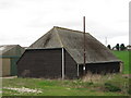

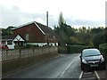
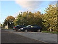
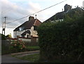
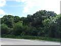
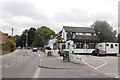
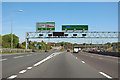
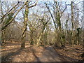
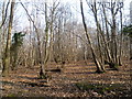
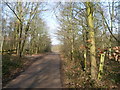
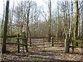
33 photos from this area
Area Information
Key information about the DA2 8AH including its size, population, and administrative classification.
- Area Type
- Postcode
- Area Size
- 72.4 hectares
- Population
- 1993
- Population Density
- 834 people/km²
House Prices in DA2 8AH
13
Properties
-
Average Sold Price
-
Lowest Price
-
Highest Price
Showing 13 properties
| Address | Type | Beds | Baths | Last Sale Price | Last Sale Date | |
|---|---|---|---|---|---|---|
| Watling House, Watling Street, Bean, DA2 8AH | Flat | 2 | - | - | - | |
| Flat 1, Merry Chest Cottage, Watling Street, Bean, DA2 8AH | Detached | 4 | - | - | - | |
| Flat 2, Merry Chest Cottage, Watling Street, Bean, DA2 8AH | Land | - | - | - | - | |
| Land Adjacent To Oakwood, Watling Street, Bean, DA2 8AH | shop | - | - | - | - | |
| Caravan To The Rear Of, The Thrift, Watling Street, Bean, DA2 8AH | Mobile Home | - | - | - | - | |
| The Gatehouse, The Thrift, Watling Street, Bean, DA2 8AH | Detached | - | - | - | - | |
| The Bungalow Rear Of Watling House, Watling Street, Bean, DA2 8AH | Bungalow | - | - | - | - | |
| Merry Chest Cafe, Watling Street, Bean, DA2 8AH | restaurant_cafe | - | - | - | - | |
| Esp Studios, Repeater House, Watling Street, Bean, DA2 8AH | Office | - | - | - | - | |
| The Thrift, Watling Street, Bean, DA2 8AH | Detached | - | - | - | - |
Page 1 of 2
Energy Efficiency in DA2 8AH
Amenities
Schools
| Rank | School | Type | Entry gender | Ages |
|---|
Explore more schools in this area
Go to Schools tabDemographics
Household Size
Family (3-5 people)
most common
Accommodation Type
Houses
most common
Tenure
84
majority
Ethnic Group
White
most common
Religion
N/A
most common
Household Composition
N/A
most common
Age
47
median
Adults (30-64 years)
most common
Household Deprivation
N/A
with no deprivation
NS-SEC
57
in Lower managerial occupations
Explore more demographic insights in this area
Go to Demographics tabPlanning
Planning Constraints
- Flood RiskPremium
- Ramsar Wetland SitesPremium
- Area of Outstanding Natural BeautyPremium
- Protected Nature ReservePremium
- Protected WoodlandPremium