Area Overview for DA2 7WZ
Photos of DA2 7WZ


Area Information
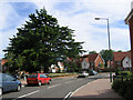
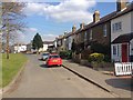
DA2 7WZ is a small, tightly packed postcode area in Kent, England, encompassing semi-rural pockets like Maypole, Dartford Heath, and Leyton Cross. With a population of 2,728 people and a density of 2,405 per square kilometre, it reflects a compact, closely knit community. The area’s character is shaped by its proximity to Dartford Heath, a historic common land with roots in medieval times. This space, once quarried for building materials, now offers a blend of natural and historical features, including earthworks from the 18th century and remnants of wartime activity. Daily life here is grounded in local traditions and nearby amenities, with easy access to rail stations like Crayford and Albany Park. The area’s semi-rural charm contrasts with its practical connectivity, making it appealing to those seeking a balance between quiet living and urban accessibility. Residents benefit from a mix of historical sites, such as Bowman’s Lodge, and modern conveniences like supermarkets and ferry services. The postcode’s small size means it’s a microcosm of Kent’s rural-urban interface, where heritage and contemporary needs coexist.
- Area Type
- Postcode
- Area Size
- Not available
- Population
- 2728
- Population Density
- 2405 people/km²
The property market in DA2 7WZ is characterised by a high rate of home ownership (74%) and a predominance of houses. This suggests a market skewed towards owner-occupied properties, with limited rental availability. The concentration of houses, rather than flats or apartments, indicates a preference for private, detached living, likely appealing to families and professionals seeking space. Given the small size of the postcode area, the housing stock is likely limited, making it a niche market for buyers prioritising specific locations. The immediate surroundings may offer more options, but proximity to Dartford Heath and semi-rural settings could influence property values. Buyers should consider the area’s compact nature, which may mean competition for available homes. The high home ownership rate also implies a stable market, though the lack of rental properties might limit flexibility for those requiring short-term tenancies.
House Prices in DA2 7WZ
No properties found in this postcode.
Energy Efficiency in DA2 7WZ
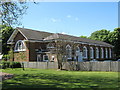
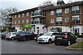
DA2 7WZ offers a mix of practical amenities and historical sites. Local shops like Sainsburys Crayford and Morrisons Daily provide everyday essentials, while rail stations such as Crayford and Albany Park facilitate commuting. The area’s proximity to Dartford Heath, a semi-rural common land, offers recreational opportunities, including walking and historical exploration of 18th-century earthworks. The Woolwich Arsenal Pier ferry service adds a unique dimension to local transport. The character of the area is defined by its blend of natural spaces and urban convenience, with Dartford Heath serving as a central green space. This balance supports a lifestyle that values both tranquillity and accessibility, making it suitable for those who appreciate a mix of semi-rural and suburban living.
Amenities
Schools
The nearest school to DA2 7WZ is Maypole Primary School, which serves the primary education needs of local children. The absence of secondary schools in the immediate area means families may need to look beyond the postcode for secondary education, potentially affecting convenience for parents. The presence of a primary school suggests a focus on early education within the community, though the lack of data on Ofsted ratings or academic performance means its quality remains unspecified. For families prioritising a single school, Maypole Primary School is a key consideration, but the need for additional schooling options should be factored into long-term planning. The school’s location within the area reinforces its role as a central amenity for residents.
| Rank | School | Type | Entry gender | Ages |
|---|
Explore more schools in this area
Go to Schools tabDemographics
DA2 7WZ has a median age of 47, with the majority of residents falling in the 30–64 age range. This suggests a mature, stable population, likely with established careers and family ties to the area. Home ownership is high at 74%, indicating a community of long-term residents rather than transient renters. The accommodation is predominantly houses, reflecting a preference for private, detached living. The predominant ethnic group is White, aligning with broader demographic trends in the region. While no specific deprivation data is provided, the high home ownership rate and age profile suggest a relatively affluent, settled population. However, the median age also implies a potential need for age-friendly infrastructure and services. The absence of detailed diversity statistics means the community’s cultural composition remains less defined, but the focus on houses and older residents points to a specific demographic profile.
Household Size
Accommodation Type
Tenure
Ethnic Group
Religion
Household Composition
Age
Household Deprivation
NS-SEC
Explore more demographic insights in this area
Go to Demographics tabPlanning
Planning Constraints
- Flood RiskPremium
- Ramsar Wetland SitesPremium
- Area of Outstanding Natural BeautyPremium
- Protected Nature ReservePremium
- Protected WoodlandPremium