Area Overview for DA2 6ZF
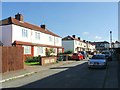
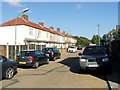
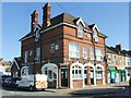
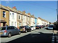
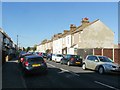
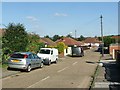
Photos of DA2 6ZF


Area Information
DA2 6ZF is a small, residential postcode area in Stone near Dartford, Kent, encompassing around 2,106 residents. Historically shaped by the former Stone House Hospital, which operated from 1866 to 2005, the area now features housing developed on the site of the former asylum. Its compact size means it is tightly defined, with a mix of modern and historic architecture. The postcode lies within the Stone House Ward, part of Dartford Borough Council, and is positioned near key transport links. Daily life here is characterised by proximity to rail services, retail outlets, and ferry terminals, offering both convenience and a sense of community. The area’s redevelopment from a former hospital site reflects a blend of practical housing needs and local heritage, though its small population ensures a more intimate, neighbourly atmosphere compared to larger urban centres. For those seeking a quiet, manageable living environment with access to essential services, DA2 6ZF provides a distinct mix of historical background and modern amenities.
- Area Type
- Postcode
- Area Size
- Not available
- Population
- 2106
- Population Density
- 3649 people/km²
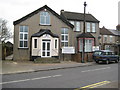
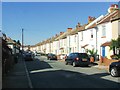
DA2 6ZF is primarily a homeowners’ area, with 61% of properties owned by their occupants. The accommodation type is predominantly houses, indicating a lack of high-density housing such as flats or apartments. This suggests a semi-rural or suburban character, where larger properties are the norm. Given the area’s small size and historical redevelopment from the former Stone House Hospital site, the housing stock is likely limited, making it a niche market. Buyers should consider that the area’s proximity to Dartford and its transport links may attract those seeking a balance between residential tranquillity and commuter accessibility. However, the small population and limited housing supply could mean competition for available properties. For those prioritising owner-occupation and a house-based lifestyle, DA2 6ZF offers a focused, manageable market.
House Prices in DA2 6ZF
No properties found in this postcode.
Energy Efficiency in DA2 6ZF
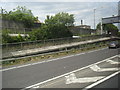
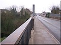
Living in DA2 6ZF offers access to essential amenities within practical reach. Retail options include Co-op Colney, Co-op Temple, and Tesco Dartford E, providing everyday shopping convenience. The area’s rail stations, such as Dartford and Greenhithe for Bluewater, connect residents to broader networks, while ferry terminals like Tilbury Ferry Terminal offer alternative transport routes. The presence of multiple rail and ferry services enhances mobility, making it easier to access larger towns or cities. The small postcode area’s proximity to these services suggests a lifestyle that balances local convenience with regional connectivity. While the area lacks large-scale leisure or entertainment venues, its transport links and retail options support a functional, community-oriented daily life.
Amenities
Schools
| Rank | School | Type | Entry gender | Ages |
|---|
Explore more schools in this area
Go to Schools tabDemographics
The population of DA2 6ZF is 2,106, with a median age of 47. The majority of residents fall within the 30-64 age range, indicating a community skewed toward middle-aged and older adults. Home ownership stands at 61%, suggesting a stable, long-term resident base, though the remaining 39% likely consists of renters or leaseholders. The predominant accommodation type is houses, reflecting a suburban or semi-rural character. The area’s demographic profile shows a strong presence of the White ethnic group, with no specific data provided on other ethnicities. The age distribution implies a mature population, which may influence local services and amenities. While no deprivation data is explicitly stated, the home ownership rate and age profile suggest a community with established roots and relatively stable economic conditions.
Household Size
Accommodation Type
Tenure
Ethnic Group
Religion
Household Composition
Age
Household Deprivation
NS-SEC
Explore more demographic insights in this area
Go to Demographics tabPlanning
Planning Constraints
- Flood RiskPremium
- Ramsar Wetland SitesPremium
- Area of Outstanding Natural BeautyPremium
- Protected Nature ReservePremium
- Protected WoodlandPremium