Area Overview for DA2 6NQ
Photos of DA2 6NQ

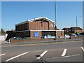
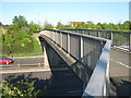
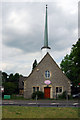
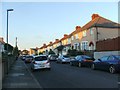
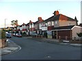
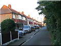
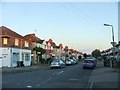
77 photos from this area
Area Information
Key information about the DA2 6NQ including its size, population, and administrative classification.
- Area Type
- Postcode
- Area Size
- 1.7 hectares
- Population
- 1911
- Population Density
- 1364 people/km²
House Prices in DA2 6NQ
7
Properties
£113,000
Average Sold Price
£65,000
Lowest Price
£161,000
Highest Price
Showing 7 properties
| Address | Type | Beds | Baths | Last Sale Price | Last Sale Date | |
|---|---|---|---|---|---|---|
| 528 Princes Road, Dartford, DA2 6NQ | Semi-detached | 3 | - | £161,000 | Jul 2003 | |
| 532 Princes Road, Dartford, DA2 6NQ | house | - | - | £65,000 | Apr 1999 | |
| Miller & Carter, 522 Princes Road, Dartford, DA2 6NQ | Leisure | - | - | - | - | |
| 524 Princes Road, Dartford, DA2 6NQ | Semi-detached | - | - | - | - | |
| 530 Princes Road, Dartford, DA2 6NQ | Semi-detached | - | - | - | - | |
| 526 Princes Road, Dartford, DA2 6NQ | Semi-detached | - | - | - | - | |
| 534 Princes Road, Dartford, DA2 6NQ | Semi-detached | - | - | - | - |
Energy Efficiency in DA2 6NQ
Amenities
Schools
| Rank | School | Type | Entry gender | Ages |
|---|
Explore more schools in this area
Go to Schools tabDemographics
Household Size
Family (3-5 people)
most common
Accommodation Type
Houses
most common
Tenure
66
majority
Ethnic Group
White
most common
Religion
N/A
most common
Household Composition
N/A
most common
Age
47
median
Adults (30-64 years)
most common
Household Deprivation
N/A
with no deprivation
NS-SEC
27
in Lower managerial occupations
Explore more demographic insights in this area
Go to Demographics tabPlanning
Planning Constraints
- Flood RiskPremium
- Ramsar Wetland SitesPremium
- Area of Outstanding Natural BeautyPremium
- Protected Nature ReservePremium
- Protected WoodlandPremium