Area Overview for DA2 6NG
Photos of DA2 6NG
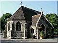
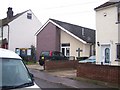
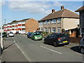
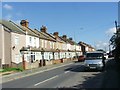
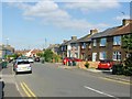
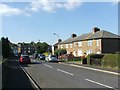
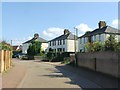
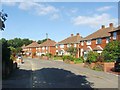
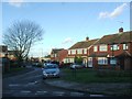
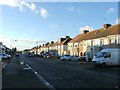
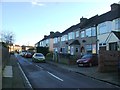
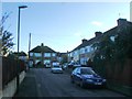
37 photos from this area
Area Information
Key information about the DA2 6NG including its size, population, and administrative classification.
- Area Type
- Postcode
- Area Size
- 8025 m²
- Population
- 1911
- Population Density
- 1364 people/km²
House Prices in DA2 6NG
22
Properties
£314,975
Average Sold Price
£146,500
Lowest Price
£550,000
Highest Price
Showing 22 properties
| Address | Type | Beds | Baths | Last Sale Price | Last Sale Date | |
|---|---|---|---|---|---|---|
| 546 Princes Road, Dartford, DA2 6NG | Semi-detached | 3 | 1 | £450,000 | Jul 2024 | |
| 578 Princes Road, Dartford, DA2 6NG | Semi-detached | 4 | 2 | £550,000 | Dec 2022 | |
| 552 Princes Road, Dartford, DA2 6NG | Semi-detached | 4 | 2 | £347,000 | Nov 2020 | |
| 572 Princes Road, Dartford, DA2 6NG | Semi-detached | 5 | 1 | £412,000 | Sep 2020 | |
| 570 Princes Road, Dartford, DA2 6NG | Semi-detached | 3 | 1 | £349,250 | Jun 2018 | |
| 568 Princes Road, Dartford, DA2 6NG | Semi-detached | 4 | - | £302,000 | Jul 2017 | |
| 550 Princes Road, Dartford, DA2 6NG | Semi-detached | - | - | £232,000 | Dec 2006 | |
| 562 Princes Road, Dartford, DA2 6NG | Semi-detached | - | - | £184,000 | Aug 2006 | |
| 564 Princes Road, Dartford, DA2 6NG | Semi-detached | - | - | £177,000 | Jun 2004 | |
| 554 Princes Road, Dartford, DA2 6NG | Semi-detached | - | - | £146,500 | Aug 2002 |
Page 1 of 3
Energy Efficiency in DA2 6NG
Amenities
Schools
| Rank | School | Type | Entry gender | Ages |
|---|
Explore more schools in this area
Go to Schools tabDemographics
Household Size
Family (3-5 people)
most common
Accommodation Type
Houses
most common
Tenure
66
majority
Ethnic Group
White
most common
Religion
N/A
most common
Household Composition
N/A
most common
Age
47
median
Adults (30-64 years)
most common
Household Deprivation
N/A
with no deprivation
NS-SEC
27
in Lower managerial occupations
Explore more demographic insights in this area
Go to Demographics tabPlanning
Planning Constraints
- Flood RiskPremium
- Ramsar Wetland SitesPremium
- Area of Outstanding Natural BeautyPremium
- Protected Nature ReservePremium
- Protected WoodlandPremium