Area Overview for DA2 6LF
Photos of DA2 6LF
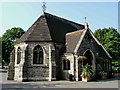
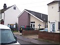
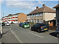
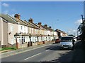
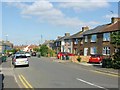
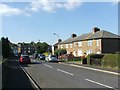
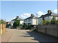
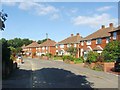
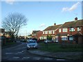
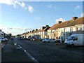
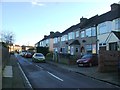
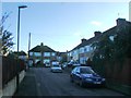
37 photos from this area
Area Information
Key information about the DA2 6LF including its size, population, and administrative classification.
- Area Type
- Postcode
- Area Size
- 2.5 hectares
- Population
- Not available
- Population Density
- Not available
House Prices in DA2 6LF
59
Properties
£224,883
Average Sold Price
£37,500
Lowest Price
£499,000
Highest Price
Showing 59 properties
| Address | Type | Beds | Baths | Last Sale Price | Last Sale Date | |
|---|---|---|---|---|---|---|
| 45 Weardale Avenue, Dartford, DA2 6LF | Semi-detached | 3 | 1 | £390,000 | Jun 2025 | |
| 71 Weardale Avenue, Dartford, DA2 6LF | Semi-detached | 3 | 1 | £420,000 | Oct 2023 | |
| 93 Weardale Avenue, Dartford, DA2 6LF | Maisonette | 2 | 1 | £230,000 | Jul 2023 | |
| 15 Weardale Avenue, Dartford, DA2 6LF | Semi-detached | 3 | 1 | £382,250 | May 2023 | |
| 115 Weardale Avenue, Dartford, DA2 6LF | Retail | 3 | 2 | £440,000 | Aug 2022 | |
| 3 Weardale Avenue, Dartford, DA2 6LF | Maisonette | 2 | 1 | £499,000 | Apr 2022 | |
| 113 Weardale Avenue, Dartford, DA2 6LF | Flat | - | - | £215,000 | Sep 2021 | |
| 49 Weardale Avenue, Dartford, DA2 6LF | house | - | - | £330,000 | Jun 2021 | |
| 97 Weardale Avenue, Dartford, DA2 6LF | Maisonette | - | - | £177,500 | Mar 2021 | |
| 89 Weardale Avenue, Dartford, DA2 6LF | Flat | 2 | 1 | £210,000 | Nov 2020 |
Page 1 of 6
Energy Efficiency in DA2 6LF
Amenities
Schools
| Rank | School | Type | Entry gender | Ages |
|---|
Explore more schools in this area
Go to Schools tabDemographics
Household Size
Family (3-5 people)
most common
Accommodation Type
Houses
most common
Tenure
89
majority
Ethnic Group
White
most common
Religion
N/A
most common
Household Composition
N/A
most common
Age
47
median
Adults (30-64 years)
most common
Household Deprivation
N/A
with no deprivation
NS-SEC
33
in Lower managerial occupations
Explore more demographic insights in this area
Go to Demographics tabPlanning
Planning Constraints
- Flood RiskPremium
- Ramsar Wetland SitesPremium
- Area of Outstanding Natural BeautyPremium
- Protected Nature ReservePremium
- Protected WoodlandPremium