Area Overview for DA2 6JU
Photos of DA2 6JU


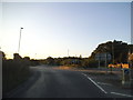

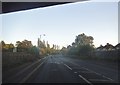
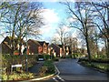

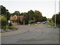


40 photos from this area
Area Information
Key information about the DA2 6JU including its size, population, and administrative classification.
- Area Type
- Postcode
- Area Size
- 5658 m²
- Population
- 1367
- Population Density
- 598 people/km²
House Prices in DA2 6JU
18
Properties
£230,943
Average Sold Price
£71,995
Lowest Price
£460,000
Highest Price
Showing 18 properties
| Address | Type | Beds | Baths | Last Sale Price | Last Sale Date | |
|---|---|---|---|---|---|---|
| 64 The Green, Darenth, DA2 6JU | Terraced | 3 | 2 | £445,000 | Feb 2023 | |
| 69 The Green, Darenth, DA2 6JU | house | 2 | 2 | £310,000 | Jun 2020 | |
| 61 The Green, Darenth, DA2 6JU | house | 3 | 2 | £460,000 | Feb 2020 | |
| 65 The Green, Darenth, DA2 6JU | house | - | - | £140,000 | May 2018 | |
| 66 The Green, Darenth, DA2 6JU | Terraced | 2 | - | £315,000 | Jul 2017 | |
| 57 The Green, Darenth, DA2 6JU | Semi-detached | 3 | 1 | £250,000 | May 2013 | |
| 62 The Green, Darenth, DA2 6JU | house | - | - | £300,000 | Feb 2013 | |
| 56 The Green, Darenth, DA2 6JU | Semi-detached | 3 | 2 | £228,000 | Sep 2009 | |
| 59 The Green, Darenth, DA2 6JU | house | 3 | - | £249,999 | May 2004 | |
| 60 The Green, Darenth, DA2 6JU | Terraced | 3 | - | £249,995 | May 2004 |
Page 1 of 2
Energy Efficiency in DA2 6JU
Amenities
Schools
| Rank | School | Type | Entry gender | Ages |
|---|
Explore more schools in this area
Go to Schools tabDemographics
Household Size
Family (3-5 people)
most common
Accommodation Type
Houses
most common
Tenure
86
majority
Ethnic Group
White
most common
Religion
N/A
most common
Household Composition
N/A
most common
Age
47
median
Adults (30-64 years)
most common
Household Deprivation
N/A
with no deprivation
NS-SEC
39
in Lower managerial occupations
Explore more demographic insights in this area
Go to Demographics tabPlanning
Planning Constraints
- Flood RiskPremium
- Ramsar Wetland SitesPremium
- Area of Outstanding Natural BeautyPremium
- Protected Nature ReservePremium
- Protected WoodlandPremium