Area Overview for DA13 9ZR
Photos of DA13 9ZR
Area Information
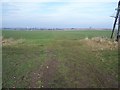
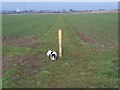
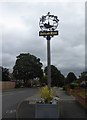
DA13 9ZR is a small, tightly knit residential area in Kent, nestled within the Istead Rise, Cobham & Luddesdown electoral ward. With a population of 1,847 and a density of 523 people per square kilometre, it reflects a compact community where local connections are strong. The area’s history is rooted in rural traditions, with medieval landmarks like Cobham’s St Mary Magdalene’s Church and 12th-century Luddesdown Court nearby. Istead Rise, though more urbanised than its surrounding parishes, retains a village feel, linked to Cobham and Luddesdown via the A2. Daily life here balances proximity to nature with modern conveniences: a small parade of shops, a GP surgery, and community facilities. The area’s growth, from a 1907 road to a modern settlement, underscores its evolving character, yet its charm lies in its quiet, stable environment. For those seeking a place with historical depth, low crime rates, and accessible transport, DA13 9ZR offers a blend of tradition and practicality.
- Area Type
- Postcode
- Area Size
- Not available
- Population
- 1847
- Population Density
- 523 people/km²
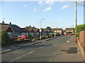
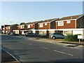
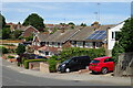
DA13 9ZR is primarily an owner-occupied area, with 92% of properties in private hands. The housing stock consists almost entirely of houses, reflecting a suburban, family-focused market. This contrasts with areas dominated by flats or rental properties, making DA13 9ZR appealing to buyers seeking long-term stability. The high home ownership rate suggests limited turnover, which can drive property values upward over time. For buyers, the small size of the area means competition for available homes, particularly given the proximity to historical sites like Cobham Hall and the A2’s role in connectivity. The predominance of houses also implies larger living spaces, ideal for families or those prioritising space. However, the limited number of properties may restrict options for first-time buyers, necessitating a focus on nearby areas for broader choices. The market’s strength is underpinned by the area’s safety, low crime rates, and access to amenities, making it a desirable yet niche investment.
House Prices in DA13 9ZR
No properties found in this postcode.
Energy Efficiency in DA13 9ZR
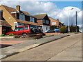
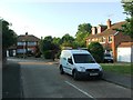
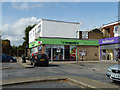
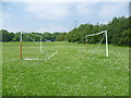
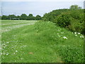
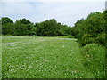
Living in DA13 9ZR offers a mix of convenience and local character. The area’s retail scene includes Co-op Istead, Spar, and Morrisons Painters, providing essentials within walking distance. A small parade of shops, including a pharmacy, butcher, and Indian restaurant, adds to the daily vibrancy. The community centre, rebuilt after a 2007 fire, serves as a hub for local activities. Proximity to Cobham and Luddesdown brings access to historic sites like Cobham Hall and St Peter and St Paul Church, as well as parks and open spaces. The A2 ensures easy travel to nearby towns, while rail stations offer swift links to London. The area’s blend of rural heritage and modern amenities makes it ideal for those seeking a balance between tradition and practicality. Whether shopping, dining, or exploring nearby landmarks, residents enjoy a lifestyle that is both connected and grounded in local history.
Amenities
Schools
| Rank | School | Type | Entry gender | Ages |
|---|
Explore more schools in this area
Go to Schools tabDemographics
The population of DA13 9ZR is predominantly adults aged 30–64, with a median age of 47, reflecting a mature, settled community. Home ownership is exceptionally high at 92%, indicating a strong preference for long-term residency over rental living. The area is characterised by houses rather than flats, aligning with its suburban, family-oriented profile. The predominant ethnic group is White, which shapes the cultural and social fabric of the neighbourhood. This demographic profile suggests a community focused on stability and continuity, with fewer transient residents. The absence of specific deprivation data means quality of life is inferred from low crime rates and accessible amenities. For instance, the 92% home ownership rate likely supports local services and infrastructure, ensuring they cater to long-term residents. The age range also implies a demand for schools, healthcare, and community spaces, which are evident in nearby facilities like the rebuilt community centre.
Household Size
Accommodation Type
Tenure
Ethnic Group
Religion
Household Composition
Age
Household Deprivation
NS-SEC
Explore more demographic insights in this area
Go to Demographics tabPlanning
Planning Constraints
- Flood RiskPremium
- Ramsar Wetland SitesPremium
- Area of Outstanding Natural BeautyPremium
- Protected Nature ReservePremium
- Protected WoodlandPremium
- Crime RiskPremium