Area Overview for DA13 9PN
Photos of DA13 9PN

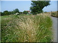
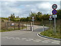
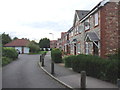
23 photos from this area
Area Information
Key information about the DA13 9PN including its size, population, and administrative classification.
- Area Type
- Postcode
- Area Size
- 1.0 km²
- Population
- 1847
- Population Density
- 523 people/km²
House Prices in DA13 9PN
22
Properties
£611,336
Average Sold Price
£400,000
Lowest Price
£937,500
Highest Price
Showing 22 properties
| Address | Type | Beds | Baths | Last Sale Price | Last Sale Date | |
|---|---|---|---|---|---|---|
| 1, The Stables, Northfleet Green, Northfleet, Gravesend, DA13 9PN | Terraced | 4 | 2 | £770,000 | Oct 2024 | |
| Landway House, Northfleet Green, Northfleet, Gravesend, DA13 9PN | house | - | - | £540,000 | May 2024 | |
| Willow Croft, Northfleet Green, Northfleet, Gravesend, DA13 9PN | Detached | 4 | 2 | £870,000 | May 2022 | |
| 5, The Stables, Northfleet Green, Northfleet, Gravesend, DA13 9PN | Terraced | 4 | 2 | £585,000 | Apr 2022 | |
| 4, The Stables, Northfleet Green, Northfleet, Gravesend, DA13 9PN | Terraced | 4 | 2 | £489,995 | Nov 2020 | |
| The Oast, Northfleet Green, Northfleet, Gravesend, DA13 9PN | Semi-detached | 4 | 3 | £937,500 | May 2016 | |
| Hazells Barn, Northfleet Green, Northfleet, Gravesend, DA13 9PN | Semi-detached | 4 | 3 | £895,000 | May 2016 | |
| 6, The Stables, Northfleet Green, Northfleet, Gravesend, DA13 9PN | house | - | - | £436,208 | Apr 2016 | |
| 7, The Stables, Northfleet Green, Northfleet, Gravesend, DA13 9PN | Terraced | 4 | 1 | £475,000 | Mar 2016 | |
| 2, The Stables, Northfleet Green, Northfleet, Gravesend, DA13 9PN | house | - | - | £450,000 | Mar 2016 |
Page 1 of 3
Energy Efficiency in DA13 9PN
Amenities
Schools
| Rank | School | Type | Entry gender | Ages |
|---|
Explore more schools in this area
Go to Schools tabDemographics
Household Size
Two person
most common
Accommodation Type
Houses
most common
Tenure
92
majority
Ethnic Group
White
most common
Religion
N/A
most common
Household Composition
N/A
most common
Age
47
median
Adults (30-64 years)
most common
Household Deprivation
N/A
with no deprivation
NS-SEC
36
in Lower managerial occupations
Explore more demographic insights in this area
Go to Demographics tabPlanning
Planning Constraints
- Flood RiskPremium
- Ramsar Wetland SitesPremium
- Area of Outstanding Natural BeautyPremium
- Protected Nature ReservePremium
- Protected WoodlandPremium