Area Overview for DA13 0LW
Photos of DA13 0LW

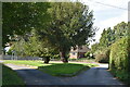
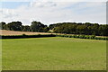
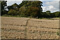
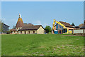
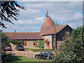
23 photos from this area
Area Information
Key information about the DA13 0LW including its size, population, and administrative classification.
- Area Type
- Postcode
- Area Size
- 15.6 hectares
- Population
- 1458
- Population Density
- 293 people/km²
House Prices in DA13 0LW
27
Properties
£397,056
Average Sold Price
£99,500
Lowest Price
£708,000
Highest Price
Showing 27 properties
| Address | Type | Beds | Baths | Last Sale Price | Last Sale Date | |
|---|---|---|---|---|---|---|
| 32 Orchard Drive, Meopham, Gravesend, DA13 0LW | Bungalow | - | - | £507,500 | Nov 2023 | |
| 50 Orchard Drive, Meopham, Gravesend, DA13 0LW | Bungalow | 4 | 2 | £708,000 | Jul 2023 | |
| 12 Orchard Drive, Meopham, Gravesend, DA13 0LW | Semi-detached | 3 | 1 | £556,000 | Mar 2023 | |
| 26 Orchard Drive, Meopham, Gravesend, DA13 0LW | Semi-detached | 3 | 1 | £425,000 | May 2018 | |
| 48 Orchard Drive, Meopham, Gravesend, DA13 0LW | Bungalow | 3 | 1 | £440,000 | Jan 2018 | |
| 22 Orchard Drive, Meopham, Gravesend, DA13 0LW | Semi-detached | 3 | 1 | £424,000 | Aug 2017 | |
| 52 Orchard Drive, Meopham, Gravesend, DA13 0LW | Semi-detached | 3 | 2 | £460,000 | Jul 2017 | |
| 20 Orchard Drive, Meopham, Gravesend, DA13 0LW | Bungalow | - | - | £450,000 | Apr 2017 | |
| 40 Orchard Drive, Meopham, Gravesend, DA13 0LW | Bungalow | - | - | £490,000 | Jan 2017 | |
| 42 Orchard Drive, Meopham, Gravesend, DA13 0LW | Semi-detached | 3 | 2 | £510,000 | Oct 2015 |
Page 1 of 3
Energy Efficiency in DA13 0LW
Amenities
Schools
| Rank | School | Type | Entry gender | Ages |
|---|
Explore more schools in this area
Go to Schools tabDemographics
Household Size
Two person
most common
Accommodation Type
Houses
most common
Tenure
87
majority
Ethnic Group
White
most common
Religion
N/A
most common
Household Composition
N/A
most common
Age
47
median
Adults (30-64 years)
most common
Household Deprivation
N/A
with no deprivation
NS-SEC
45
in Lower managerial occupations
Explore more demographic insights in this area
Go to Demographics tabPlanning
Planning Constraints
- Flood RiskPremium
- Ramsar Wetland SitesPremium
- Area of Outstanding Natural BeautyPremium
- Protected Nature ReservePremium
- Protected WoodlandPremium