Area Overview for DA12 5UE
Photos of DA12 5UE


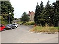
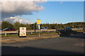


29 photos from this area
Area Information
Key information about the DA12 5UE including its size, population, and administrative classification.
- Area Type
- Postcode
- Area Size
- 2.9 hectares
- Population
- 1675
- Population Density
- 5017 people/km²
House Prices in DA12 5UE
23
Properties
£510,152
Average Sold Price
£118,500
Lowest Price
£1,050,000
Highest Price
Showing 23 properties
| Address | Type | Beds | Baths | Last Sale Price | Last Sale Date | |
|---|---|---|---|---|---|---|
| 423 Valley Drive, Gravesend, DA12 5UE | house | 4 | 2 | £605,000 | Nov 2023 | |
| 419 Valley Drive, Gravesend, DA12 5UE | Detached | 5 | 3 | £372,324 | Oct 2021 | |
| Sunnyside, Valley Drive, Gravesend, DA12 5UE | house | - | - | £1,050,000 | Jul 2021 | |
| Woodlands, Valley Drive, Gravesend, DA12 5UE | Detached | 5 | 2 | £770,000 | Sep 2018 | |
| The Ridges, Valley Drive, Gravesend, DA12 5UE | house | 5 | - | £792,000 | Jan 2015 | |
| 429 Valley Drive, Gravesend, DA12 5UE | house | 5 | - | £640,000 | Jun 2012 | |
| 421 Valley Drive, Gravesend, DA12 5UE | house | - | - | £382,500 | Aug 2011 | |
| Woodside, Valley Drive, Gravesend, DA12 5UE | house | - | - | £400,000 | May 2009 | |
| 417 Valley Drive, Gravesend, DA12 5UE | Detached | - | - | £305,000 | Mar 2004 | |
| Cobham Lodge, Valley Drive, Gravesend, DA12 5UE | house | 4 | - | £436,500 | Jun 2003 |
Page 1 of 3
Energy Efficiency in DA12 5UE
Amenities
Schools
| Rank | School | Type | Entry gender | Ages |
|---|
Explore more schools in this area
Go to Schools tabDemographics
Household Size
Family (3-5 people)
most common
Accommodation Type
Houses
most common
Tenure
61
majority
Ethnic Group
White
most common
Religion
N/A
most common
Household Composition
N/A
most common
Age
47
median
Adults (30-64 years)
most common
Household Deprivation
N/A
with no deprivation
NS-SEC
24
in Lower managerial occupations
Explore more demographic insights in this area
Go to Demographics tabPlanning
Planning Constraints
- Flood RiskPremium
- Ramsar Wetland SitesPremium
- Area of Outstanding Natural BeautyPremium
- Protected Nature ReservePremium
- Protected WoodlandPremium