Area Overview for DA12 4TT
Photos of DA12 4TT
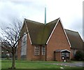
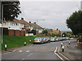

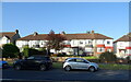
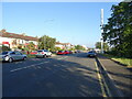
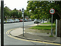
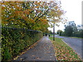
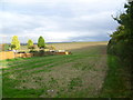
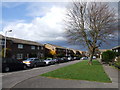
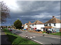
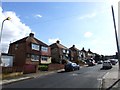
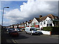
17 photos from this area
Area Information
Key information about the DA12 4TT including its size, population, and administrative classification.
- Area Type
- Postcode
- Area Size
- 1.9 hectares
- Population
- 1373
- Population Density
- 1235 people/km²
House Prices in DA12 4TT
39
Properties
£235,217
Average Sold Price
£63,470
Lowest Price
£415,000
Highest Price
Showing 39 properties
| Address | Type | Beds | Baths | Last Sale Price | Last Sale Date | |
|---|---|---|---|---|---|---|
| 364 Rochester Road, Gravesend, DA12 4TT | Terraced | 3 | 1 | £345,000 | Oct 2024 | |
| 370 Rochester Road, Gravesend, DA12 4TT | Terraced | 4 | 1 | £390,000 | Jun 2023 | |
| 362 Rochester Road, Gravesend, DA12 4TT | Terraced | 3 | 2 | £402,500 | Mar 2023 | |
| 330 Rochester Road, Gravesend, DA12 4TT | house | 3 | - | £415,000 | Nov 2022 | |
| 322 Rochester Road, Gravesend, DA12 4TT | house | - | - | £337,500 | Aug 2021 | |
| 366 Rochester Road, Gravesend, DA12 4TT | house | - | - | £303,000 | May 2021 | |
| 344 Rochester Road, Gravesend, DA12 4TT | house | - | - | £315,000 | Mar 2021 | |
| 376 Rochester Road, Gravesend, DA12 4TT | Terraced | 4 | 2 | £355,000 | Nov 2020 | |
| 316 Rochester Road, Gravesend, DA12 4TT | Semi-detached | 3 | 1 | £300,020 | Feb 2019 | |
| 346 Rochester Road, Gravesend, DA12 4TT | Semi-detached | 3 | 2 | £273,000 | Oct 2015 |
Page 1 of 4
Energy Efficiency in DA12 4TT
Amenities
Schools
| Rank | School | Type | Entry gender | Ages |
|---|
Explore more schools in this area
Go to Schools tabDemographics
Household Size
Family (3-5 people)
most common
Accommodation Type
Houses
most common
Tenure
74
majority
Ethnic Group
White
most common
Religion
N/A
most common
Household Composition
N/A
most common
Age
47
median
Adults (30-64 years)
most common
Household Deprivation
N/A
with no deprivation
NS-SEC
26
in Lower managerial occupations
Explore more demographic insights in this area
Go to Demographics tabPlanning
Planning Constraints
- Flood RiskPremium
- Ramsar Wetland SitesPremium
- Area of Outstanding Natural BeautyPremium
- Protected Nature ReservePremium
- Protected WoodlandPremium