Area Overview for DA12 3EN
Photos of DA12 3EN
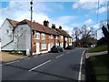
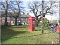
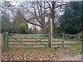
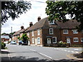
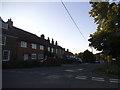


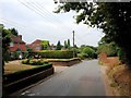
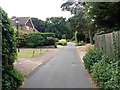
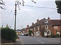

30 photos from this area
Area Information
Key information about the DA12 3EN including its size, population, and administrative classification.
- Area Type
- Postcode
- Area Size
- 16.8 hectares
- Population
- 1230
- Population Density
- 93 people/km²
House Prices in DA12 3EN
22
Properties
£781,857
Average Sold Price
£335,000
Lowest Price
£2,298,000
Highest Price
Showing 22 properties
| Address | Type | Beds | Baths | Last Sale Price | Last Sale Date | |
|---|---|---|---|---|---|---|
| Inis Coilite, Tanyard Hill, Shorne, Gravesend, DA12 3EN | Detached | 3 | 2 | £740,000 | Feb 2025 | |
| The Old Police House, Tanyard Hill, Shorne, Gravesend, DA12 3EN | Detached | 4 | 3 | £1,100,000 | Mar 2023 | |
| Long Mead, Tanyard Hill, Shorne, Gravesend, DA12 3EN | house | - | - | £725,000 | Nov 2021 | |
| Yew Cottage, Tanyard Hill, Shorne, Gravesend, DA12 3EN | Detached | 5 | 5 | £610,000 | Jun 2021 | |
| Westdene Cottage, Tanyard Hill, Shorne, Gravesend, DA12 3EN | Detached | 5 | 5 | £635,000 | Jul 2020 | |
| Tanners Grange, Tanyard Hill, Shorne, Gravesend, DA12 3EN | Detached | 5 | 4 | £2,298,000 | Feb 2020 | |
| Denmark House, Tanyard Hill, Shorne, Gravesend, DA12 3EN | Semi-detached | 4 | 1 | £673,000 | Jun 2018 | |
| Fleet With, Tanyard Hill, Shorne, Gravesend, DA12 3EN | Detached | 4 | 2 | £640,000 | Feb 2018 | |
| Silverdene, Tanyard Hill, Shorne, Gravesend, DA12 3EN | Detached | 3 | 1 | £565,000 | Oct 2017 | |
| Cherrywood, Tanyard Hill, Shorne, Gravesend, DA12 3EN | house | - | - | £335,000 | Mar 2013 |
Page 1 of 3
Energy Efficiency in DA12 3EN
Amenities
Schools
| Rank | School | Type | Entry gender | Ages |
|---|
Explore more schools in this area
Go to Schools tabDemographics
Household Size
Two person
most common
Accommodation Type
Houses
most common
Tenure
78
majority
Ethnic Group
White
most common
Religion
N/A
most common
Household Composition
N/A
most common
Age
47
median
Adults (30-64 years)
most common
Household Deprivation
N/A
with no deprivation
NS-SEC
43
in Lower managerial occupations
Explore more demographic insights in this area
Go to Demographics tabPlanning
Planning Constraints
- Flood RiskPremium
- Ramsar Wetland SitesPremium
- Area of Outstanding Natural BeautyPremium
- Protected Nature ReservePremium
- Protected WoodlandPremium