Area Overview for DA12 3AS
Photos of DA12 3AS
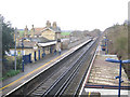
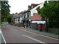

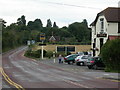
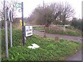

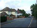
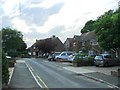
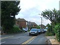
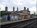
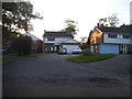
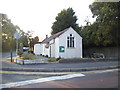
51 photos from this area
Area Information
Key information about the DA12 3AS including its size, population, and administrative classification.
- Area Type
- Postcode
- Area Size
- 2.2 hectares
- Population
- 1483
- Population Density
- 129 people/km²
House Prices in DA12 3AS
49
Properties
£321,772
Average Sold Price
£78,000
Lowest Price
£550,000
Highest Price
Showing 49 properties
| Address | Type | Beds | Baths | Last Sale Price | Last Sale Date | |
|---|---|---|---|---|---|---|
| 24 Scratton Fields, Cobham, Gravesend, DA12 3AS | Semi-detached | 4 | - | £550,000 | Aug 2024 | |
| 12 Scratton Fields, Cobham, Gravesend, DA12 3AS | Semi-detached | 2 | 1 | £413,000 | Oct 2023 | |
| 19 Scratton Fields, Cobham, Gravesend, DA12 3AS | Semi-detached | 3 | 2 | £450,000 | Oct 2022 | |
| 9 Scratton Fields, Cobham, Gravesend, DA12 3AS | house | - | - | £505,000 | Jun 2022 | |
| 5 Scratton Fields, Cobham, Gravesend, DA12 3AS | Retail | 2 | 1 | £375,000 | Mar 2022 | |
| 14 Scratton Fields, Cobham, Gravesend, DA12 3AS | house | - | - | £405,000 | Aug 2021 | |
| 11 Scratton Fields, Cobham, Gravesend, DA12 3AS | house | - | - | £360,000 | Apr 2021 | |
| 37 Scratton Fields, Cobham, Gravesend, DA12 3AS | house | 3 | - | £500,000 | Nov 2020 | |
| 7 Scratton Fields, Cobham, Gravesend, DA12 3AS | Semi-detached | 2 | 1 | £295,000 | Dec 2019 | |
| 10 Scratton Fields, Cobham, Gravesend, DA12 3AS | Semi-detached | 3 | 2 | £490,000 | Dec 2019 |
Page 1 of 5
Energy Efficiency in DA12 3AS
Amenities
Schools
| Rank | School | Type | Entry gender | Ages |
|---|
Explore more schools in this area
Go to Schools tabDemographics
Household Size
Two person
most common
Accommodation Type
Houses
most common
Tenure
78
majority
Ethnic Group
White
most common
Religion
N/A
most common
Household Composition
N/A
most common
Age
47
median
Adults (30-64 years)
most common
Household Deprivation
N/A
with no deprivation
NS-SEC
46
in Lower managerial occupations
Explore more demographic insights in this area
Go to Demographics tabPlanning
Planning Constraints
- Flood RiskPremium
- Ramsar Wetland SitesPremium
- Area of Outstanding Natural BeautyPremium
- Protected Nature ReservePremium
- Protected WoodlandPremium