Area Overview for DA12 3AD
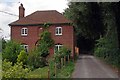
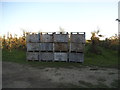
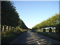
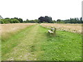
Photos of DA12 3AD


Area Information
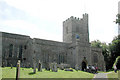
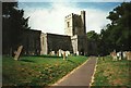
Living in DA12 3AD means settling in a rural village with a strong historical identity and a quiet, picturesque atmosphere. The area, part of the Gravesham district in Kent, has a population of 1,483 spread across 129 people per square kilometre, creating a close-knit community feel. Its character is defined by over 450 listed buildings, including the 13th-century Church of St Mary Magdalene and Cobham Hall, a late Elizabethan house linked to The Ashes urn. The village sits near the M2 motorway and the A2, offering a balance of rural tranquillity and practical connectivity. Residents benefit from proximity to agricultural land, historic sites, and a network of rail stations. With a median age of 47 and a predominance of adults aged 30–64, DA12 3AD is a stable area where homes are largely owner-occupied, reflecting a community rooted in tradition. The village’s links to Charles Dickens and medieval heritage add to its appeal, making it a place where history and modern life coexist.
- Area Type
- Postcode
- Area Size
- Not available
- Population
- 1483
- Population Density
- 129 people/km²
DA12 3AD is a predominantly owner-occupied area, with 78% of homes owned by their residents. This high rate of home ownership suggests a stable, long-term community with limited rental activity. The accommodation type is largely houses, which is typical for rural villages where larger properties are common. Given the area’s small size and historical architecture, the housing stock likely includes older, well-maintained homes with spacious grounds. Buyers should expect a market focused on family homes rather than apartments or modern developments. The limited number of properties means the area is not suited for speculative investment but rather for those seeking a quiet, established residence. Proximity to the M2 motorway and nearby rail stations adds practical value, though the rural setting ensures a slower pace of life compared to urban areas.
House Prices in DA12 3AD
No properties found in this postcode.
Energy Efficiency in DA12 3AD
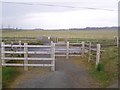
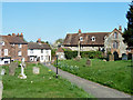
DA12 3AD offers a lifestyle shaped by its rural setting and historical charm. Residents have access to retail outlets such as Morrisons Daily and Tesco Meopham, ensuring everyday shopping needs are met. The village’s proximity to rail stations and ferry terminals enhances mobility, while its agricultural surroundings provide open spaces for leisure. Landmarks like the Leather Bottle Inn, linked to Charles Dickens, and the National Trust’s Owletts add cultural and historical depth. The area’s mix of listed buildings, parks, and quiet streets creates a distinctive character, appealing to those who value heritage and tranquillity. While the village is small, its amenities and transport links make it practical for both local living and broader regional engagement.
Amenities
Schools
The nearest school to DA12 3AD is Cobham Primary School, a primary school with an outstanding Ofsted rating. This rating indicates high standards in teaching, pupil outcomes, and overall performance. The presence of a top-rated primary school makes DA12 3AD an attractive option for families with young children, reducing the need to commute for education. While no secondary schools are listed in the data, the proximity to Cobham’s historical and cultural sites suggests a community that values both education and heritage. Families may need to look further afield for secondary schooling, but the primary school’s excellence provides a strong foundation for early education.
| Rank | School | Type | Entry gender | Ages |
|---|
Explore more schools in this area
Go to Schools tabDemographics
DA12 3AD has a median age of 47, with the majority of residents aged between 30 and 64. This suggests a mature, settled population, likely with established careers and families. Home ownership is high at 78%, indicating a community of long-term residents rather than a transient rental market. The area’s accommodation is predominantly houses, which aligns with its rural character and larger property sizes. The predominant ethnic group is White, reflecting the demographic profile of much of rural Kent. While no specific data on deprivation is provided, the high home ownership rate and stable age distribution suggest a generally secure quality of life. The absence of detailed diversity statistics means the community’s full composition remains less defined, but the data underscores a cohesive, family-oriented environment.
Household Size
Accommodation Type
Tenure
Ethnic Group
Religion
Household Composition
Age
Household Deprivation
NS-SEC
Explore more demographic insights in this area
Go to Demographics tabPlanning
Planning Constraints
- Flood RiskPremium
- Ramsar Wetland SitesPremium
- Area of Outstanding Natural BeautyPremium
- Protected Nature ReservePremium
- Protected WoodlandPremium