Area Overview for DA12 2XX
Photos of DA12 2XX
Area Information
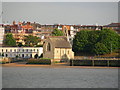
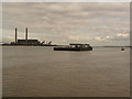
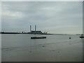
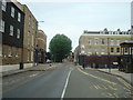
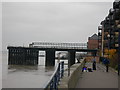
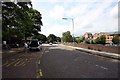
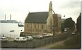
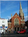
DA12 2XX is a compact residential postcode in Kent, situated on the south bank of the River Thames, 21 miles east-southeast of Charing Cross in London. The area covers 576 m² and is home to 1,920 residents, making it one of the most densely populated regions in England, with 3.3 million people per square kilometre. Its proximity to the Thames and historical ties to the Roman Watling Street (now the A2) underscore its strategic location. The postcode falls within the Borough of Gravesham, near the town of Gravesend, which was recorded as Gravesham in the Domesday Book of 1086. Daily life here is shaped by its small-scale character, with residents living close to key transport routes, including rail stations and ferry terminals. The area’s compact size means amenities are within practical reach, though its high population density reflects a focus on efficient land use. For buyers, DA12 2XX offers a blend of historical context and modern connectivity, though its small footprint means the community is tightly knit, with limited expansion potential.
- Area Type
- Postcode
- Area Size
- 576 m²
- Population
- Not available
- Population Density
- Not available
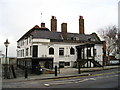
DA12 2XX is characterised by a rental market, with only 27% of homes owner-occupied, indicating a strong reliance on private rented accommodation. The accommodation type is predominantly flats, which aligns with the area’s high population density and compact footprint. This suggests a housing stock tailored for smaller households or individuals, with limited scope for larger family homes. The small size of the postcode—just 576 m²—means the property market is constrained, with limited land for new developments. For buyers, this presents challenges: the area is unlikely to see significant new housing supply, and the existing stock is largely flats, which may not suit all preferences. Proximity to transport links, including rail and ferry services, could offset the lack of home ownership opportunities for those prioritising connectivity over property type. However, the high proportion of rental properties may also mean competition for available flats, particularly for those seeking long-term ownership.
House Prices in DA12 2XX
Showing 1 properties
| Address | Type | Beds | Baths | Last Sale Price | Last Sale Date | |
|---|---|---|---|---|---|---|
| 29-30 King Street, Gravesend, DA12 2XX | retail_financial | - | - | - | - |
Energy Efficiency in DA12 2XX
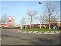
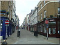
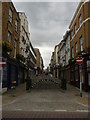
Residents of DA12 2XX have access to a range of nearby amenities within practical reach. Retail options include Farmfoods Gravesend, Tesco Gravesend, and Budgens Clock, providing essential shopping needs. The area’s transport links—five rail stations and three ferry terminals—connect residents to broader networks, facilitating both daily commutes and leisure travel. While specific parks or recreational spaces are not detailed in the data, the proximity to the River Thames suggests opportunities for walking or water-based activities. The historical significance of the area, including the Grade II* listed Town Hall and Royal Terrace Pier, adds cultural depth to the local environment. However, the lack of explicit information on dining or leisure venues means the full character of the area’s lifestyle remains partially defined. The compact nature of DA12 2XX ensures convenience for essential services, though larger-scale amenities may require a trip to nearby towns.
Amenities
Schools
| Rank | School | Type | Entry gender | Ages |
|---|
Explore more schools in this area
Go to Schools tabDemographics
DA12 2XX has a median age of 47, with the majority of residents aged 30–64, indicating a mature adult population. Only 27% of homes are owner-occupied, suggesting a rental-dominated market, and flats are the predominant accommodation type. The area’s demographic profile reflects a community with limited generational turnover, as the age range skews toward middle-aged adults. The predominant ethnic group is White, though specific diversity metrics are not provided. With 1,920 residents in a 576 m² area, the population density is exceptionally high, which may impact living conditions and community dynamics. This density, combined with the low proportion of owner-occupied homes, suggests a transient or rental-focused population. The absence of data on deprivation or income levels means the quality of life implications of these figures remain unquantified, but the high population density could influence local services and infrastructure pressure.
Household Size
Accommodation Type
Tenure
Ethnic Group
Religion
Household Composition
Age
Household Deprivation
NS-SEC
Explore more demographic insights in this area
Go to Demographics tabPlanning
Planning Constraints
- Flood RiskPremium
- Ramsar Wetland SitesPremium
- Area of Outstanding Natural BeautyPremium
- Protected Nature ReservePremium
- Protected WoodlandPremium