Area Overview for DA12 2QX
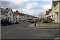
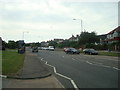
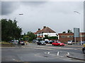
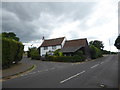
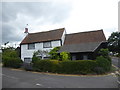
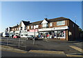
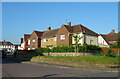
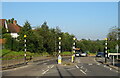
Photos of DA12 2QX


Area Information
DA12 2QX is a compact residential cluster in the Gravesham borough of Kent, encompassing just 4.1 hectares with a population of 1,826. This small area, part of Denton Ward, is distinct from the village of Denton in Dover District, lying at coordinates 51.434353, 0.388195. Its high population density of 44,913 people per square kilometre reflects a tightly knit community, typical of urbanised postcode areas. The area’s proximity to Gravesend and its transport links make it accessible for commuters, while its small size fosters a localised feel. Residents here are likely to find daily life shaped by nearby amenities, including retail, rail, and ferry services. The area’s focus on housing, with 64% owner-occupied properties, suggests a stable, long-term resident base. While the postcode’s limited size means it is not a sprawling suburb, its strategic location near major transport routes and services offers convenience for those prioritising connectivity over space.
- Area Type
- Postcode
- Area Size
- 4.1 hectares
- Population
- Not available
- Population Density
- Not available
DA12 2QX is characterised by a high rate of home ownership, with 64% of properties owned by residents rather than rented. This suggests a market skewed towards owner-occupied homes, which may reflect the area’s compact nature and the presence of established residents. The accommodation type is predominantly houses, which is notable given the postcode’s small size. This could indicate a mix of semi-detached or terraced housing, typical of smaller urban clusters. For buyers, this means the available housing stock is limited to a small number of properties, potentially increasing competition. The area’s proximity to transport links and amenities may make it attractive to those seeking a balance between urban convenience and residential space. However, the small size of DA12 2QX means that the immediate surroundings, such as nearby postcode areas, are likely to hold more significant property diversity for buyers seeking broader options.
House Prices in DA12 2QX
No properties found in this postcode.
Energy Efficiency in DA12 2QX
The lifestyle in DA12 2QX is shaped by its proximity to retail, rail, and ferry services. Within practical reach are five retail outlets, including Co-op Gravesend and Asda Chalk, offering everyday shopping needs. The presence of three ferry terminals, such as West Street Pier and Tilbury Ferry Terminal, suggests easy access to water-based travel, which could be particularly useful for those working in nearby towns or ports. Five rail stations, including Northfleet Railway Station, provide frequent connections to larger cities and employment hubs. While the area lacks detailed information on parks or leisure facilities, the density of transport and retail options implies a convenience-focused lifestyle. Residents are likely to rely on these services for both daily tasks and broader mobility, though the small size of DA12 2QX means that more extensive leisure or recreational options may be found in nearby postcodes.
Amenities
Schools
Near DA12 2QX are two St John’s Catholic schools, both primary institutions, and one St John’s Catholic Comprehensive, which is also listed as a primary school in the data. The comprehensive school holds an Ofsted rating of ‘good’, indicating a reliable educational standard. This mix of primary schools suggests that families in the area have access to both foundational and secondary education, though the data does not specify the comprehensive’s exact role. The repetition of St John’s Catholic Primary School in the data may reflect a local network of schools serving the community. For parents, the presence of a ‘good’-rated comprehensive is a positive, though the lack of secondary school data means it is unclear whether the area supports full secondary education locally. Families may need to consider nearby postcodes for secondary schooling, given the limited school types listed here.
| Rank | School | Type | Entry gender | Ages |
|---|
Explore more schools in this area
Go to Schools tabDemographics
The population of DA12 2QX has a median age of 47, with the majority of residents aged between 30 and 64. This indicates a mature community, likely with established families and professionals. Home ownership is high at 64%, reflecting a preference for long-term residency over renting. The predominant accommodation type is houses, which aligns with the area’s compact layout and the presence of a small residential cluster. The predominant ethnic group is White, though the data does not provide further breakdowns of diversity. The age profile suggests a balance between working-age adults and those nearing retirement, which may influence local services and amenities. With no specific deprivation data provided, the area’s quality of life appears tied to its infrastructure and connectivity. The high home ownership rate and mature demographic suggest stability, though the small size of the area may limit the diversity of household types.
Household Size
Accommodation Type
Tenure
Ethnic Group
Religion
Household Composition
Age
Household Deprivation
NS-SEC
Explore more demographic insights in this area
Go to Demographics tabPlanning
Planning Constraints
- Flood RiskPremium
- Ramsar Wetland SitesPremium
- Area of Outstanding Natural BeautyPremium
- Protected Nature ReservePremium
- Protected WoodlandPremium