Area Overview for DA12 2EN
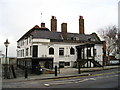
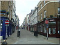
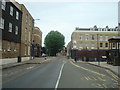
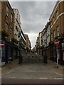
Photos of DA12 2EN


Area Information
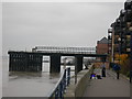
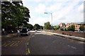
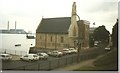
DA12 2EN is a small residential cluster in the Borough of Gravesham, Kent, situated on the south bank of the River Thames. With a population of 2,038 and an area of 854 m², it is a densely populated postcode, reflecting its role as a compact urban hub. The area’s proximity to central Gravesend and its historical roots—dating back to its mention in the Domesday Book as Gravesham—anchor it in a region with rich heritage. Residents here benefit from proximity to the Thames, which historically shaped Gravesend’s identity as a key transport and maritime centre. The area’s compact size means amenities and services are within walking or short driving distance, though its small footprint also means housing options are limited. Daily life is influenced by its location on Watling Street, a historic Roman road now part of the A2, and its role as a gateway to London via rail and ferry links. The mix of modern and historic elements, from the Grade II* listed Town Hall to the Royal Terrace Pier, offers a unique character that blends practicality with local history.
- Area Type
- Postcode
- Area Size
- 854 m²
- Population
- Not available
- Population Density
- Not available
DA12 2EN’s property market is characterised by a low home ownership rate (26%) and a dominance of flats, reflecting its status as a small, densely populated residential cluster. This suggests the area is more rental-focused than owner-occupied, with limited scope for property investment in larger homes. The compact size of the postcode means housing options are constrained, and buyers should consider the broader Gravesham area for more variety. Flats are the primary accommodation type, likely catering to commuters or those prioritising proximity to transport links. For buyers, the low home ownership rate may indicate competition for available properties, though the area’s proximity to rail and ferry services could offset its limitations. Those seeking a larger property may need to look beyond DA12 2EN, but the area’s small footprint ensures a tight-knit community with accessible amenities.
House Prices in DA12 2EN
Showing 1 properties
| Address | Type | Beds | Baths | Last Sale Price | Last Sale Date | |
|---|---|---|---|---|---|---|
| Pharmacy, Gravesend Medical Centre, 1 New Swan Yard, Gravesend, DA12 2EN | retail_financial | - | - | - | - |
Energy Efficiency in DA12 2EN
DA12 2EN’s residents have access to a range of amenities within practical reach. Retail options include Farmfoods Gravesend, Tesco Gravesend, and Budgens Clock, offering everyday shopping needs. The area’s proximity to the River Thames also connects it to historic sites like Royal Terrace Pier, which has significance for maritime history. Three ferry terminals provide transport links across the river, while rail stations such as Northfleet and Tilbury Town Railway Station offer connections to London and other regional centres. The presence of multiple retail and transport hubs suggests a convenience-driven lifestyle, with services clustered in nearby Gravesend. However, the area’s small size means larger leisure or entertainment options are located further afield. The mix of historic and practical amenities reflects a community that balances local heritage with modern necessities.
Amenities
Schools
DA12 2EN is served by three schools: Chantry Primary School, Chantry Community Primary School, and Pier View Academy. Both primary schools have an Ofsted rating of “good,” indicating strong performance in education and student outcomes. Pier View Academy, a special school, provides tailored support for students with specific needs. The mix of primary and special schools suggests the area caters to families with diverse educational requirements. For parents, the presence of two primary schools with good ratings offers flexibility in choosing schools, while Pier View Academy ensures specialist provision is available. The proximity of these schools to the postcode means daily commutes are minimal, reinforcing the area’s appeal for families. However, the absence of secondary schools within the immediate vicinity may necessitate travel to nearby towns like Gravesend or Tilbury for older children.
| Rank | School | Type | Entry gender | Ages |
|---|
Explore more schools in this area
Go to Schools tabDemographics
DA12 2EN has a median age of 47, with the majority of residents aged 30–64, indicating a mature, settled community. Home ownership is low at 26%, suggesting most residents are renters, which may reflect the area’s limited housing stock and its role as a secondary residential zone. The predominant accommodation type is flats, aligning with the compact nature of the postcode. The population is predominantly White, with no specific data on other ethnic groups provided. The high population density—2,386,520 people per km²—suggests a mix of long-term residents and those living in nearby areas. This density, combined with the age profile, implies a community focused on stability and proximity to services. The absence of detailed deprivation data means quality of life factors like access to healthcare or leisure remain unquantified, though the area’s amenities suggest a baseline of convenience for daily needs.
Household Size
Accommodation Type
Tenure
Ethnic Group
Religion
Household Composition
Age
Household Deprivation
NS-SEC
Explore more demographic insights in this area
Go to Demographics tabPlanning
Planning Constraints
- Flood RiskPremium
- Ramsar Wetland SitesPremium
- Area of Outstanding Natural BeautyPremium
- Protected Nature ReservePremium
- Protected WoodlandPremium