Area Overview for DA12 1LH
Photos of DA12 1LH
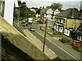
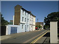
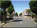

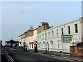
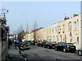
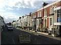
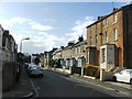
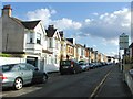
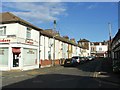
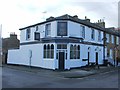
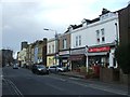
100 photos from this area
Area Information
Key information about the DA12 1LH including its size, population, and administrative classification.
- Area Type
- Postcode
- Area Size
- 8247 m²
- Population
- 1589
- Population Density
- 6256 people/km²
House Prices in DA12 1LH
31
Properties
£519,071
Average Sold Price
£66,000
Lowest Price
£950,000
Highest Price
Showing 31 properties
| Address | Type | Beds | Baths | Last Sale Price | Last Sale Date | |
|---|---|---|---|---|---|---|
| 94 Windmill Street, Gravesend, DA12 1LH | Detached | 12 | 6 | £950,000 | Apr 2020 | |
| 91 Windmill Street, Gravesend, DA12 1LH | house | - | - | £862,500 | Dec 2019 | |
| 90C Windmill Street, Gravesend, DA12 1LH | house | 4 | 2 | £530,000 | Mar 2017 | |
| 93 Windmill Street, Gravesend, DA12 1LH | Semi-detached | - | - | £500,000 | May 2016 | |
| 92 Windmill Street, Gravesend, DA12 1LH | Semi-detached | - | - | £495,000 | Apr 2016 | |
| 90A Windmill Street, Gravesend, DA12 1LH | Semi-detached | 3 | 1 | £229,995 | Aug 2003 | |
| 90D Windmill Street, Gravesend, DA12 1LH | Semi-detached | - | - | £66,000 | Apr 1996 | |
| Briars Court, 90 Windmill Street, Gravesend, DA12 1LH | Detached | 7 | 4 | - | - | |
| 90B Windmill Street, Gravesend, DA12 1LH | Semi-detached | 7 | 1 | - | - | |
| Ground Floor, Dolphin Court, 95 Windmill Street, Gravesend, DA12 1LH | Maisonette | 3 | - | - | - |
Page 1 of 4
Energy Efficiency in DA12 1LH
Amenities
Schools
| Rank | School | Type | Entry gender | Ages |
|---|
Explore more schools in this area
Go to Schools tabDemographics
Household Size
Family (3-5 people)
most common
Accommodation Type
Houses
most common
Tenure
68
majority
Ethnic Group
White
most common
Religion
N/A
most common
Household Composition
N/A
most common
Age
47
median
Adults (30-64 years)
most common
Household Deprivation
N/A
with no deprivation
NS-SEC
36
in Lower managerial occupations
Explore more demographic insights in this area
Go to Demographics tabPlanning
Planning Constraints
- Flood RiskPremium
- Ramsar Wetland SitesPremium
- Area of Outstanding Natural BeautyPremium
- Protected Nature ReservePremium
- Protected WoodlandPremium