Area Overview for DA12 1EU
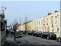
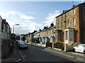
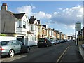
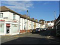
Photos of DA12 1EU


Area Information
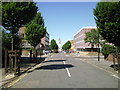
DA12 1EU is a small residential postcode in the Borough of Gravesham, Kent, situated on the south bank of the River Thames. With a population of just 1,920, it reflects the quiet, compact nature of the area, which has historical roots dating back to its mention in the Domesday Book as Gravesham. The postcode lies 21 miles east-southeast of Charing Cross, placing it within commuting distance of London while retaining a distinct local character. The area’s proximity to the Thames and its historical ties to maritime activity—such as the Royal Terrace Pier, built in 1844—add to its heritage. Modern residents benefit from nearby transport links, including railway stations and ferry terminals, while the surrounding landscape includes remnants of Roman roads and medieval settlements. This blend of history and practicality makes DA12 1EU a niche choice for those seeking a low-key, community-oriented lifestyle with access to both natural and urban amenities.
- Area Type
- Postcode
- Area Size
- Not available
- Population
- Not available
- Population Density
- Not available
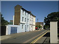
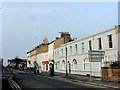
The property market in DA12 1EU is characterised by a low home ownership rate of 27%, suggesting that the area is primarily a rental market. The accommodation type is predominantly flats, which may reflect older housing stock or purpose-built developments catering to specific demographics. This dynamic implies limited opportunities for owner-occupied properties, potentially making the area more attractive to renters or those seeking short-term housing solutions. The small population and compact nature of the postcode mean the housing stock is unlikely to be diverse, with few new developments likely to alter this balance. For buyers, the focus would be on existing flats, though the low home ownership rate may indicate a lack of long-term investment in property. The area’s proximity to transport links and amenities may offset its limitations for those prioritising convenience over property value growth.
House Prices in DA12 1EU
No properties found in this postcode.
Energy Efficiency in DA12 1EU
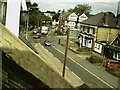
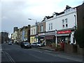
Living in DA12 1EU offers access to a range of practical amenities within close proximity. Retail options include Farmfoods Gravesend, Tesco Gravesend, and Budgens Clock, providing essential shopping for daily needs. The area’s transport links are extensive, with five railway stations—Gravesend, Tilbury Town, and Northfleet—facilitating easy travel to London and beyond. Ferry services at Town Pier, West Street Pier, and Tilbury Ferry Terminal connect residents to the River Thames, offering both scenic routes and functional transport. While the area lacks large-scale leisure facilities, its historical significance—such as the Royal Terrace Pier—adds cultural depth. The compact nature of DA12 1EU means amenities are concentrated, making it convenient for residents who prioritise accessibility over sprawling urban environments. The blend of practical services and historical context creates a lifestyle focused on efficiency and local heritage.
Amenities
Schools
| Rank | School | Type | Entry gender | Ages |
|---|
Explore more schools in this area
Go to Schools tabDemographics
The population of DA12 1EU has a median age of 47, with the majority of residents aged between 30 and 64. This suggests a mature, stable community with a focus on established households. Home ownership is relatively low at 27%, indicating that the area is more rental-oriented than owner-occupied. The predominant accommodation type is flats, reflecting a housing stock shaped by older developments. The predominant ethnic group is White, though specific diversity figures are not provided. The age profile and home ownership rate suggest a mix of long-term residents and those seeking affordable housing in a semi-rural setting. The low deprivation data, while not explicitly stated, aligns with the area’s moderate population size and access to essential services, though the lack of detailed socioeconomic metrics means broader quality-of-life implications remain unquantified.
Household Size
Accommodation Type
Tenure
Ethnic Group
Religion
Household Composition
Age
Household Deprivation
NS-SEC
Explore more demographic insights in this area
Go to Demographics tabPlanning
Planning Constraints
- Flood RiskPremium
- Ramsar Wetland SitesPremium
- Area of Outstanding Natural BeautyPremium
- Protected Nature ReservePremium
- Protected WoodlandPremium