Area Overview for DA12 1AE
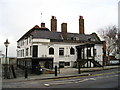
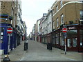
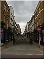
Photos of DA12 1AE


Area Information
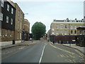
Living in DA12 1AE means residing in a specific postcode cluster within the Town Ward of Gravesend, located on the south bank of the River Thames. This small residential area spans 188 square metres and supports a population of 1,920 people. Situated approximately 35 kilometres east-southeast of Charing Cross, the location sits within the administrative boundaries of the Borough of Gravesham in Kent. The area has deep historical roots, tracing back to records in the Domesday Book of 1086 as Gravesham, owned by Odo, Earl of Kent. Formerly an extensive Roman settlement, the vicinity includes archaeological evidence from Vagniacae along Watling Street. Today, the postcode covers a compact footprint, making it a tight-knit community defined by its proximity to the river rather than vast green spaces. Residents benefit from a setting that balances urban convenience with historical significance, lying just north of the A2 road that follows the banks of the Thames. The neighbourhood operates as a distinct part of central Gravesend, offering access to a mix of modern utilities and ancient landmarks.
- Area Type
- Postcode
- Area Size
- 188 m²
- Population
- Not available
- Population Density
- Not available
The housing landscape in DA12 1AE is characterised by a specific lack of home ownership, with only 27 per cent of residents owning their home outright. This statistic places the area firmly within the rental sector, where the majority of the 1,920 population occupies leased accommodation. Most properties are flats, a design choice that suits the narrow footprint of the 188 square metre postcode and the urban density of central Gravesend. Business owners and potential buyers looking for traditional terraced houses or detached family homes in this specific postcode will find few options available. Instead, the market offers compact living spaces that maximise the limited land area. For those seeking to purchase, the high rental proportion suggests a location where tenants outnumber landlords significantly. The accommodation type dictates a different approach for investment strategies compared to owner-occupied estates. Residents rely heavily on the existing infrastructure designed for multi-occupancy dwellings rather than single-family housing clusters. The prevalence of flats within this small cluster indicates a demand for urban-style living close to the river and town centre amenities.
House Prices in DA12 1AE
No properties found in this postcode.
Energy Efficiency in DA12 1AE
Residents of DA12 1AE enjoy immediate access to a variety of amenities within practical reach. Five retail outlets line the surrounding streets, including Farmfoods Gravesend, Tesco Gravesend, and Budgens Clock for daily shopping needs. Transport links are equally accessible, with five rail stations including Gravesend Railway Station and Northfleet Railway Station under your guidance. Three ferry terminals serve the river, notably the Town Pier and Tilbury Ferry Terminal. Historical interests are supported by Grade II* listed buildings such as the Town Hall in the adjacent Riverside Ward. The Royal Terrace Pier, built in 1844, stands as a monument to the town's maritime history and served as a base for River Thames pilots since the early 19th century. Steamboats once departed from this location, offering passages to London, echoing the current transport hub status. These facilities create a lifestyle where riverfront history meets modern retail and commuting convenience. You can walk to Tesco Gravesend or catch a train from Gravesend Railway Station without needing a car for basic daily tasks.
Amenities
Schools
| Rank | School | Type | Entry gender | Ages |
|---|
Explore more schools in this area
Go to Schools tabDemographics
The community in DA12 1AE is predominantly defined by adults aged between 30 and 64 years. The median age for residents is 47, indicating a mature demographic profile typical of established Thames-side neighbourhoods. Home ownership stands at exactly 27 per cent, suggesting that the majority of the 1,920 population rents their accommodation. Most dwellings within this postcode are flats, reflecting the density constraints of the area. The predominant ethnic group is White, consistent with the wider settlement pattern of Gravesend. A significant portion of long-term residents falls into the core workforce age bracket, shaping the local economy and family dynamic. The low rate of home ownership implies a rental market that may attract commuters or professionals already established in London or the South East seeking flexible arrangements. Housing stock remains largely uniform in type, catering primarily to those who do not own freehold properties. This demographic stability provides a predictable residential environment where neighbours have lived for considerable periods, fostering a sense of routine and local familiarity.
Household Size
Accommodation Type
Tenure
Ethnic Group
Religion
Household Composition
Age
Household Deprivation
NS-SEC
Explore more demographic insights in this area
Go to Demographics tabPlanning
Planning Constraints
- Flood RiskPremium
- Ramsar Wetland SitesPremium
- Area of Outstanding Natural BeautyPremium
- Protected Nature ReservePremium
- Protected WoodlandPremium