Area Overview for DA11 8ST
Photos of DA11 8ST
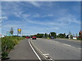
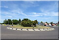
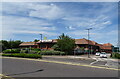
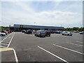
27 photos from this area
Area Information
Key information about the DA11 8ST including its size, population, and administrative classification.
- Area Type
- Postcode
- Area Size
- 1.5 hectares
- Population
- 1466
- Population Density
- 5319 people/km²
House Prices in DA11 8ST
26
Properties
£285,499
Average Sold Price
£99,995
Lowest Price
£667,500
Highest Price
Showing 26 properties
| Address | Type | Beds | Baths | Last Sale Price | Last Sale Date | |
|---|---|---|---|---|---|---|
| 21 Peach Croft, Northfleet, Gravesend, DA11 8ST | Terraced | 3 | 1 | £355,000 | Jul 2025 | |
| 2 Peach Croft, Northfleet, Gravesend, DA11 8ST | Detached | 3 | 1 | £422,500 | Feb 2024 | |
| 6 Peach Croft, Northfleet, Gravesend, DA11 8ST | house | - | - | £305,000 | Jun 2023 | |
| 18 Peach Croft, Northfleet, Gravesend, DA11 8ST | house | 2 | 1 | £285,000 | May 2022 | |
| 5 Peach Croft, Northfleet, Gravesend, DA11 8ST | house | - | - | £315,000 | Sep 2021 | |
| 14 Peach Croft, Northfleet, Gravesend, DA11 8ST | house | 5 | 2 | £667,500 | Dec 2020 | |
| 19 Peach Croft, Northfleet, Gravesend, DA11 8ST | Detached | 3 | 1 | £350,000 | Apr 2019 | |
| 26 Peach Croft, Northfleet, Gravesend, DA11 8ST | Semi-detached | 3 | 2 | £332,500 | Dec 2018 | |
| 3 Peach Croft, Northfleet, Gravesend, DA11 8ST | Semi-detached | 4 | - | £425,000 | Mar 2017 | |
| 25 Peach Croft, Northfleet, Gravesend, DA11 8ST | house | - | - | £405,000 | Mar 2016 |
Page 1 of 3
Energy Efficiency in DA11 8ST
Amenities
Schools
| Rank | School | Type | Entry gender | Ages |
|---|
Explore more schools in this area
Go to Schools tabDemographics
Household Size
One person
most common
Accommodation Type
Houses
most common
Tenure
58
majority
Ethnic Group
White
most common
Religion
N/A
most common
Household Composition
N/A
most common
Age
47
median
Adults (30-64 years)
most common
Household Deprivation
N/A
with no deprivation
NS-SEC
24
in Lower managerial occupations
Explore more demographic insights in this area
Go to Demographics tabPlanning
Planning Constraints
- Flood RiskPremium
- Ramsar Wetland SitesPremium
- Area of Outstanding Natural BeautyPremium
- Protected Nature ReservePremium
- Protected WoodlandPremium