Area Overview for DA11 8SB
Photos of DA11 8SB
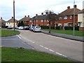
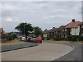
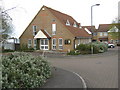
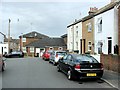
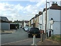
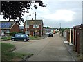
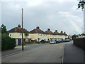
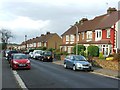
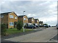
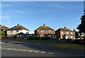
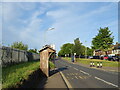
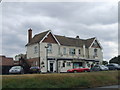
40 photos from this area
Area Information
Key information about the DA11 8SB including its size, population, and administrative classification.
- Area Type
- Postcode
- Area Size
- 6806 m²
- Population
- Not available
- Population Density
- Not available
House Prices in DA11 8SB
19
Properties
£200,636
Average Sold Price
£65,995
Lowest Price
£300,000
Highest Price
Showing 19 properties
| Address | Type | Beds | Baths | Last Sale Price | Last Sale Date | |
|---|---|---|---|---|---|---|
| 31 Chadwick Close, Northfleet, Gravesend, DA11 8SB | Terraced | 2 | 1 | £285,000 | Aug 2025 | |
| 28 Chadwick Close, Northfleet, Gravesend, DA11 8SB | Terraced | 2 | - | £300,000 | Dec 2022 | |
| 41 Chadwick Close, Northfleet, Gravesend, DA11 8SB | Semi-detached | 2 | 1 | £281,000 | Nov 2017 | |
| 26 Chadwick Close, Northfleet, Gravesend, DA11 8SB | house | - | - | £230,000 | Jan 2017 | |
| 29 Chadwick Close, Northfleet, Gravesend, DA11 8SB | Terraced | 2 | 1 | £250,550 | Sep 2016 | |
| 25 Chadwick Close, Northfleet, Gravesend, DA11 8SB | Terraced | 2 | - | £170,000 | Nov 2015 | |
| 32 Chadwick Close, Northfleet, Gravesend, DA11 8SB | house | - | - | £250,000 | Oct 2015 | |
| 34 Chadwick Close, Northfleet, Gravesend, DA11 8SB | Semi-detached | 3 | - | £249,995 | Oct 2015 | |
| 40 Chadwick Close, Northfleet, Gravesend, DA11 8SB | Semi-detached | 2 | 1 | £185,000 | May 2014 | |
| 25A Chadwick Close, Northfleet, Gravesend, DA11 8SB | house | - | - | £130,000 | Apr 2014 |
Page 1 of 2
Energy Efficiency in DA11 8SB
Amenities
Schools
| Rank | School | Type | Entry gender | Ages |
|---|
Explore more schools in this area
Go to Schools tabDemographics
Household Size
Family (3-5 people)
most common
Accommodation Type
Houses
most common
Tenure
75
majority
Ethnic Group
White
most common
Religion
N/A
most common
Household Composition
N/A
most common
Age
47
median
Adults (30-64 years)
most common
Household Deprivation
N/A
with no deprivation
NS-SEC
28
in Lower managerial occupations
Explore more demographic insights in this area
Go to Demographics tabPlanning
Planning Constraints
- Flood RiskPremium
- Ramsar Wetland SitesPremium
- Area of Outstanding Natural BeautyPremium
- Protected Nature ReservePremium
- Protected WoodlandPremium