Area Overview for DA11 8FD
Photos of DA11 8FD

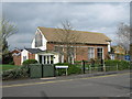
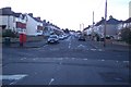
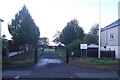
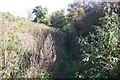

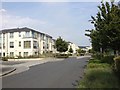

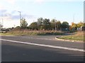

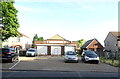
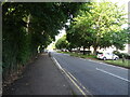
43 photos from this area
Area Information
Key information about the DA11 8FD including its size, population, and administrative classification.
- Area Type
- Postcode
- Area Size
- 8278 m²
- Population
- 1575
- Population Density
- 3884 people/km²
House Prices in DA11 8FD
44
Properties
£306,104
Average Sold Price
£52,975
Lowest Price
£430,000
Highest Price
Showing 44 properties
| Address | Type | Beds | Baths | Last Sale Price | Last Sale Date | |
|---|---|---|---|---|---|---|
| 28 Hindmarsh Crescent, Northfleet, Gravesend, DA11 8FD | Flat | 2 | 1 | £205,000 | Jun 2025 | |
| 32 Hindmarsh Crescent, Northfleet, Gravesend, DA11 8FD | Flat | 2 | 1 | £225,000 | May 2025 | |
| 20 Hindmarsh Crescent, Northfleet, Gravesend, DA11 8FD | house | - | - | £415,000 | Mar 2025 | |
| 36 Hindmarsh Crescent, Northfleet, Gravesend, DA11 8FD | Flat | - | - | £263,500 | May 2024 | |
| 54 Hindmarsh Crescent, Northfleet, Gravesend, DA11 8FD | Terraced | 4 | 2 | £412,000 | Mar 2024 | |
| 22 Hindmarsh Crescent, Northfleet, Gravesend, DA11 8FD | Flat | 1 | 1 | £52,975 | Mar 2019 | |
| 24 Hindmarsh Crescent, Northfleet, Gravesend, DA11 8FD | Flat | 2 | 1 | £240,000 | Sep 2018 | |
| 34 Hindmarsh Crescent, Northfleet, Gravesend, DA11 8FD | Flat | 1 | 1 | £207,500 | Sep 2018 | |
| 16 Hindmarsh Crescent, Northfleet, Gravesend, DA11 8FD | house | - | - | £380,000 | Sep 2018 | |
| 26 Hindmarsh Crescent, Northfleet, Gravesend, DA11 8FD | Flat | - | - | £230,000 | Sep 2018 |
Page 1 of 5
Energy Efficiency in DA11 8FD
Amenities
Schools
| Rank | School | Type | Entry gender | Ages |
|---|
Explore more schools in this area
Go to Schools tabDemographics
Household Size
Family (3-5 people)
most common
Accommodation Type
Houses
most common
Tenure
43
majority
Ethnic Group
White
most common
Religion
N/A
most common
Household Composition
N/A
most common
Age
47
median
Adults (30-64 years)
most common
Household Deprivation
N/A
with no deprivation
NS-SEC
22
in Lower managerial occupations
Explore more demographic insights in this area
Go to Demographics tabPlanning
Planning Constraints
- Flood RiskPremium
- Ramsar Wetland SitesPremium
- Area of Outstanding Natural BeautyPremium
- Protected Nature ReservePremium
- Protected WoodlandPremium