Area Overview for DA11 8EG
Photos of DA11 8EG

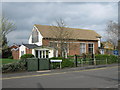
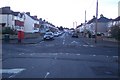


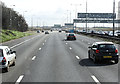
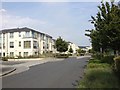
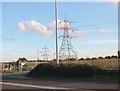
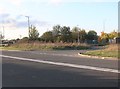

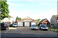
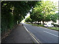
43 photos from this area
Area Information
Key information about the DA11 8EG including its size, population, and administrative classification.
- Area Type
- Postcode
- Area Size
- 1.4 hectares
- Population
- Not available
- Population Density
- Not available
House Prices in DA11 8EG
36
Properties
£292,980
Average Sold Price
£178,500
Lowest Price
£465,000
Highest Price
Showing 36 properties
| Address | Type | Beds | Baths | Last Sale Price | Last Sale Date | |
|---|---|---|---|---|---|---|
| 17 Painters Ash Lane, Northfleet, Gravesend, DA11 8EG | Detached | 2 | 1 | £340,000 | Jul 2025 | |
| 21 Painters Ash Lane, Northfleet, Gravesend, DA11 8EG | Semi-detached | 3 | 2 | £465,000 | Jun 2025 | |
| 69 Painters Ash Lane, Northfleet, Gravesend, DA11 8EG | Semi-detached | 3 | 2 | £387,500 | Apr 2024 | |
| 9 Painters Ash Lane, Northfleet, Gravesend, DA11 8EG | Bungalow | 2 | 1 | £415,000 | Mar 2024 | |
| 39 Painters Ash Lane, Northfleet, Gravesend, DA11 8EG | house | 3 | 2 | £455,000 | Aug 2022 | |
| 65 Painters Ash Lane, Northfleet, Gravesend, DA11 8EG | Semi-detached | 3 | 1 | £350,000 | Jun 2021 | |
| 5 Painters Ash Lane, Northfleet, Gravesend, DA11 8EG | house | - | - | £330,000 | Mar 2021 | |
| 33 Painters Ash Lane, Northfleet, Gravesend, DA11 8EG | Bungalow | - | - | £275,000 | Mar 2021 | |
| 23 Painters Ash Lane, Northfleet, Gravesend, DA11 8EG | Bungalow | - | - | £268,000 | Feb 2021 | |
| 31 Painters Ash Lane, Northfleet, Gravesend, DA11 8EG | Bungalow | - | - | £300,000 | Jan 2021 |
Page 1 of 4
Energy Efficiency in DA11 8EG
Amenities
Schools
| Rank | School | Type | Entry gender | Ages |
|---|
Explore more schools in this area
Go to Schools tabDemographics
Household Size
Family (3-5 people)
most common
Accommodation Type
Houses
most common
Tenure
89
majority
Ethnic Group
White
most common
Religion
N/A
most common
Household Composition
N/A
most common
Age
47
median
Adults (30-64 years)
most common
Household Deprivation
N/A
with no deprivation
NS-SEC
27
in Lower managerial occupations
Explore more demographic insights in this area
Go to Demographics tabPlanning
Planning Constraints
- Flood RiskPremium
- Ramsar Wetland SitesPremium
- Area of Outstanding Natural BeautyPremium
- Protected Nature ReservePremium
- Protected WoodlandPremium