Area Overview for DA11 7NN
Photos of DA11 7NN
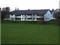
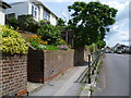
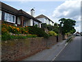
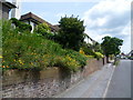

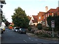
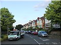
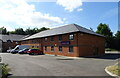
48 photos from this area
Area Information
Key information about the DA11 7NN including its size, population, and administrative classification.
- Area Type
- Postcode
- Area Size
- 9425 m²
- Population
- 1604
- Population Density
- 3385 people/km²
House Prices in DA11 7NN
26
Properties
£342,206
Average Sold Price
£78,000
Lowest Price
£648,000
Highest Price
Showing 26 properties
| Address | Type | Beds | Baths | Last Sale Price | Last Sale Date | |
|---|---|---|---|---|---|---|
| 25 Dennis Road, Gravesend, DA11 7NN | Semi-detached | 3 | 2 | £525,000 | Mar 2025 | |
| 23 Dennis Road, Gravesend, DA11 7NN | Semi-detached | 3 | 2 | £648,000 | Oct 2023 | |
| 45 Dennis Road, Gravesend, DA11 7NN | house | - | - | £550,000 | Jan 2023 | |
| 7 Dennis Road, Gravesend, DA11 7NN | Semi-detached | 3 | 1 | £645,000 | Nov 2022 | |
| 43 Dennis Road, Gravesend, DA11 7NN | Semi-detached | 3 | 1 | £425,000 | Oct 2022 | |
| 21 Dennis Road, Gravesend, DA11 7NN | house | - | - | £485,000 | Jun 2021 | |
| 29 Dennis Road, Gravesend, DA11 7NN | Semi-detached | 3 | 1 | £430,000 | Jun 2021 | |
| 17 Dennis Road, Gravesend, DA11 7NN | Semi-detached | 3 | 1 | £385,000 | Mar 2016 | |
| 13 Dennis Road, Gravesend, DA11 7NN | house | 3 | - | £412,500 | Jan 2016 | |
| 35 Dennis Road, Gravesend, DA11 7NN | Semi-detached | 3 | - | £276,500 | Jul 2014 |
Page 1 of 3
Energy Efficiency in DA11 7NN
Amenities
Schools
| Rank | School | Type | Entry gender | Ages |
|---|
Explore more schools in this area
Go to Schools tabDemographics
Household Size
Family (3-5 people)
most common
Accommodation Type
Houses
most common
Tenure
70
majority
Ethnic Group
White
most common
Religion
N/A
most common
Household Composition
N/A
most common
Age
47
median
Adults (30-64 years)
most common
Household Deprivation
N/A
with no deprivation
NS-SEC
34
in Lower managerial occupations
Explore more demographic insights in this area
Go to Demographics tabPlanning
Planning Constraints
- Flood RiskPremium
- Ramsar Wetland SitesPremium
- Area of Outstanding Natural BeautyPremium
- Protected Nature ReservePremium
- Protected WoodlandPremium