Area Overview for DA11 0ZN
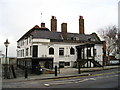
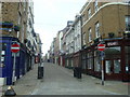
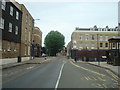
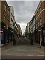
Photos of DA11 0ZN


Area Information
DA11 0ZN lies in the Borough of Gravesham, Kent, on the south bank of the River Thames, 21 miles east-southeast of Charing Cross in London. This small postcode area covers a residential cluster with a population of 1,444, reflecting its compact nature. The area’s historical roots are evident: it was recorded as Gravesham in the Domesday Book, with Roman remains and medieval mills still influencing its character. Modern Gravesend, where DA11 0ZN sits, is defined by its proximity to the Thames, offering a blend of historical architecture and practical transport links. The nearby Town Hall, a Grade II* listed building, and Royal Terrace Pier, a historic arrival point for royalty, underscore the area’s heritage. Residents benefit from immediate access to ferry terminals, rail stations, and retail hubs, creating a lifestyle balanced between tradition and convenience. The postcode’s small size means it is tightly integrated with surrounding wards, making it a compact yet connected part of the Thames-side community.
- Area Type
- Postcode
- Area Size
- Not available
- Population
- Not available
- Population Density
- Not available
The property market in DA11 0ZN is characterised by a low home ownership rate of 28%, indicating that most residents are renters rather than homeowners. The primary accommodation type is flats, which aligns with the area’s compact size and urban setting. This suggests a housing stock that is likely to be smaller in scale, with limited availability of larger family homes. For buyers, this means the area is not a strong candidate for owner-occupied properties, and those seeking to purchase may need to look beyond DA11 0ZN itself. The prevalence of flats could also imply a focus on rental yields for investors, though the small postcode size may limit the diversity of available properties. Proximity to transport links and retail amenities may offset the lack of larger homes, making the area appealing to those prioritising location over property size.
House Prices in DA11 0ZN
No properties found in this postcode.
Energy Efficiency in DA11 0ZN
DA11 0ZN offers a mix of retail, transport, and leisure options within practical reach. Nearby supermarkets include Iceland Gravesend, Tesco Gravesend, and Asda Gravesend, providing daily essentials and convenience for residents. The area’s ferry terminals and rail stations—such as Gravesend Railway Station and Tilbury Ferry Terminal—ensure easy access to London and other regional hubs. While the data does not mention parks or recreational spaces, the proximity to the River Thames and historical sites like Royal Terrace Pier suggests opportunities for outdoor activities. The presence of multiple retail outlets and transport links contributes to a lifestyle that balances local amenities with broader connectivity, making daily life both practical and varied.
Amenities
Schools
The nearest school to DA11 0ZN is Dartford and Gravesham, which is categorised as an “other” type in the data. No Ofsted rating is provided, so its educational quality cannot be assessed here. The absence of detailed school information suggests that families may need to research further to understand the academic standards and facilities available. Given the area’s small size, it is possible that residents rely on schools in nearby wards or towns such as Gravesend or Tilbury. The lack of specific data on school performance highlights the need for prospective homebuyers to consult local education authorities or school reviews for a comprehensive picture of educational options.
| Rank | School | Type | Entry gender | Ages |
|---|
Explore more schools in this area
Go to Schools tabDemographics
DA11 0ZN’s population of 1,444 is predominantly adults aged 30–64, with a median age of 47. This suggests a community rooted in middle-aged professionals and families. Home ownership is low, at 28%, indicating that a majority of residents rent their homes. The accommodation type is primarily flats, reflecting a housing stock suited to smaller households or those preferring urban living. The predominant ethnic group is White, though no specific diversity statistics are provided. The age profile implies a stable, established population, with fewer young families or retirees. This demographic mix may influence local services and amenities, shaping a community that prioritises convenience over expansive family-oriented facilities. The relatively low home ownership rate also suggests a rental market that could impact property investment opportunities in the area.
Household Size
Accommodation Type
Tenure
Ethnic Group
Religion
Household Composition
Age
Household Deprivation
NS-SEC
Explore more demographic insights in this area
Go to Demographics tabPlanning
Planning Constraints
- Flood RiskPremium
- Ramsar Wetland SitesPremium
- Area of Outstanding Natural BeautyPremium
- Protected Nature ReservePremium
- Protected WoodlandPremium