Area Overview for DA11 0SH
Photos of DA11 0SH
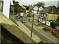
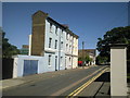
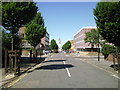
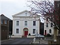
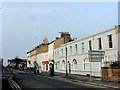
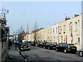
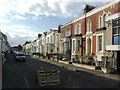
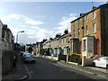
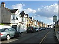
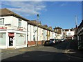
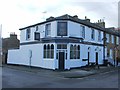
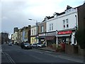
100 photos from this area
Area Information
Key information about the DA11 0SH including its size, population, and administrative classification.
- Area Type
- Postcode
- Area Size
- 6249 m²
- Population
- 1589
- Population Density
- 6256 people/km²
House Prices in DA11 0SH
22
Properties
£453,100
Average Sold Price
£298,000
Lowest Price
£565,000
Highest Price
Showing 22 properties
| Address | Type | Beds | Baths | Last Sale Price | Last Sale Date | |
|---|---|---|---|---|---|---|
| 123 Darnley Road, Gravesend, DA11 0SH | Retail | 5 | 1 | £525,000 | Sep 2022 | |
| Groundkeepers Cottage, Darnley Road, Gravesend, DA11 0SH | Detached | 3 | - | £490,000 | Jun 2021 | |
| 109 Darnley Road, Gravesend, DA11 0SH | Semi-detached | 4 | 2 | £565,000 | Oct 2018 | |
| 113 Darnley Road, Gravesend, DA11 0SH | Semi-detached | 5 | 2 | £298,000 | Aug 2009 | |
| 111 Darnley Road, Gravesend, DA11 0SH | Semi-detached | - | - | £387,500 | May 2008 | |
| 127A Darnley Road, Gravesend, DA11 0SH | Terraced | 3 | 2 | - | - | |
| 107A Darnley Road, Gravesend, DA11 0SH | Flat | 5 | 2 | - | - | |
| 125 Darnley Road, Gravesend, DA11 0SH | Semi-detached | 5 | 2 | - | - | |
| 127 Darnley Road, Gravesend, DA11 0SH | Terraced | 3 | 1 | - | - | |
| 117D Darnley Road, Gravesend, DA11 0SH | Semi-detached | 5 | 3 | - | - |
Page 1 of 3
Energy Efficiency in DA11 0SH
Amenities
Schools
| Rank | School | Type | Entry gender | Ages |
|---|
Explore more schools in this area
Go to Schools tabDemographics
Household Size
Family (3-5 people)
most common
Accommodation Type
Houses
most common
Tenure
68
majority
Ethnic Group
White
most common
Religion
N/A
most common
Household Composition
N/A
most common
Age
47
median
Adults (30-64 years)
most common
Household Deprivation
N/A
with no deprivation
NS-SEC
36
in Lower managerial occupations
Explore more demographic insights in this area
Go to Demographics tabPlanning
Planning Constraints
- Flood RiskPremium
- Ramsar Wetland SitesPremium
- Area of Outstanding Natural BeautyPremium
- Protected Nature ReservePremium
- Protected WoodlandPremium