Area Overview for DA11 0JY
Photos of DA11 0JY
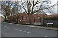
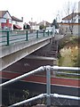
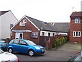
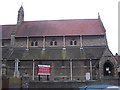
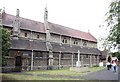
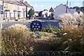
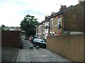
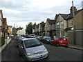
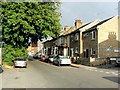
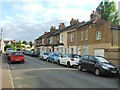
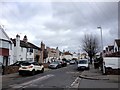
85 photos from this area
Area Information
Key information about the DA11 0JY including its size, population, and administrative classification.
- Area Type
- Postcode
- Area Size
- 1.0 hectares
- Population
- 1667
- Population Density
- 12150 people/km²
House Prices in DA11 0JY
38
Properties
£213,409
Average Sold Price
£36,000
Lowest Price
£445,000
Highest Price
Showing 38 properties
| Address | Type | Beds | Baths | Last Sale Price | Last Sale Date | |
|---|---|---|---|---|---|---|
| 60 Campbell Road, Gravesend, DA11 0JY | Terraced | 5 | 2 | £445,000 | Aug 2023 | |
| 48 Campbell Road, Gravesend, DA11 0JY | Retail | 3 | 1 | £365,000 | Oct 2022 | |
| 74 Campbell Road, Gravesend, DA11 0JY | Detached | 3 | 2 | £375,000 | Jun 2022 | |
| 24 Campbell Road, Gravesend, DA11 0JY | house | - | - | £285,000 | Mar 2022 | |
| 40 Campbell Road, Gravesend, DA11 0JY | house | - | - | £320,000 | Jun 2021 | |
| 18 Campbell Road, Gravesend, DA11 0JY | Terraced | 3 | 1 | £280,000 | Oct 2018 | |
| 28 Campbell Road, Gravesend, DA11 0JY | house | - | - | £305,000 | Apr 2018 | |
| 54 Campbell Road, Gravesend, DA11 0JY | Terraced | 4 | 1 | £295,000 | Feb 2018 | |
| 50 Campbell Road, Gravesend, DA11 0JY | Terraced | 3 | - | £340,000 | Jan 2018 | |
| 64 Campbell Road, Gravesend, DA11 0JY | house | - | - | £228,500 | Dec 2016 |
Page 1 of 4
Energy Efficiency in DA11 0JY
Amenities
Schools
| Rank | School | Type | Entry gender | Ages |
|---|
Explore more schools in this area
Go to Schools tabDemographics
Household Size
Family (3-5 people)
most common
Accommodation Type
Houses
most common
Tenure
55
majority
Ethnic Group
White
most common
Religion
N/A
most common
Household Composition
N/A
most common
Age
47
median
Adults (30-64 years)
most common
Household Deprivation
N/A
with no deprivation
NS-SEC
25
in Lower managerial occupations
Explore more demographic insights in this area
Go to Demographics tabPlanning
Planning Constraints
- Flood RiskPremium
- Ramsar Wetland SitesPremium
- Area of Outstanding Natural BeautyPremium
- Protected Nature ReservePremium
- Protected WoodlandPremium