Area Overview for DA10 1BZ
Photos of DA10 1BZ
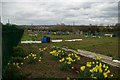
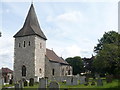
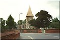
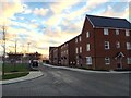
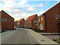
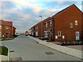
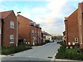
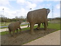
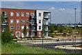
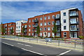
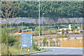
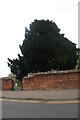
33 photos from this area
Area Information
Key information about the DA10 1BZ including its size, population, and administrative classification.
- Area Type
- Postcode
- Area Size
- 1.2 hectares
- Population
- 1512
- Population Density
- 4082 people/km²
House Prices in DA10 1BZ
18
Properties
£483,163
Average Sold Price
£354,995
Lowest Price
£685,000
Highest Price
Showing 18 properties
| Address | Type | Beds | Baths | Last Sale Price | Last Sale Date | |
|---|---|---|---|---|---|---|
| 1 Giles Drive, Castle Hill, Ebbsfleet Valley, DA10 1BZ | house | - | - | £685,000 | Jun 2021 | |
| 27 Giles Drive, Castle Hill, Ebbsfleet Valley, DA10 1BZ | house | - | - | £600,000 | Oct 2020 | |
| 7 Giles Drive, Castle Hill, Ebbsfleet Valley, DA10 1BZ | house | - | - | £430,000 | Aug 2020 | |
| 19 Giles Drive, Castle Hill, Ebbsfleet Valley, DA10 1BZ | Detached | 4 | 2 | £614,995 | Jan 2020 | |
| 21 Giles Drive, Castle Hill, Ebbsfleet Valley, DA10 1BZ | Terraced | 3 | 2 | £369,995 | Dec 2019 | |
| 31 Giles Drive, Castle Hill, Ebbsfleet Valley, DA10 1BZ | house | - | - | £495,000 | Sep 2018 | |
| 35 Giles Drive, Castle Hill, Ebbsfleet Valley, DA10 1BZ | house | - | - | £544,995 | Sep 2018 | |
| 29 Giles Drive, Castle Hill, Ebbsfleet Valley, DA10 1BZ | house | - | - | £499,995 | Aug 2018 | |
| 9 Giles Drive, Castle Hill, Ebbsfleet Valley, DA10 1BZ | Terraced | 4 | 2 | £409,995 | Jul 2018 | |
| 33 Giles Drive, Castle Hill, Ebbsfleet Valley, DA10 1BZ | house | - | - | £499,995 | Jun 2018 |
Page 1 of 2
Energy Efficiency in DA10 1BZ
Amenities
Schools
| Rank | School | Type | Entry gender | Ages |
|---|
Explore more schools in this area
Go to Schools tabDemographics
Household Size
Family (3-5 people)
most common
Accommodation Type
Houses
most common
Tenure
40
majority
Ethnic Group
White
most common
Religion
N/A
most common
Household Composition
N/A
most common
Age
47
median
Adults (30-64 years)
most common
Household Deprivation
N/A
with no deprivation
NS-SEC
18
in Lower managerial occupations
Explore more demographic insights in this area
Go to Demographics tabPlanning
Planning Constraints
- Flood RiskPremium
- Ramsar Wetland SitesPremium
- Area of Outstanding Natural BeautyPremium
- Protected Nature ReservePremium
- Protected WoodlandPremium