Area Overview for DA1 5DW
Photos of DA1 5DW
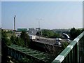
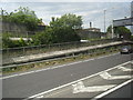
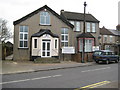
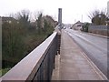
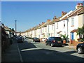
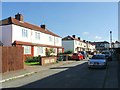
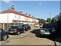
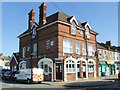
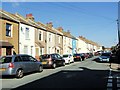
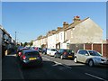
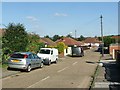
53 photos from this area
Area Information
Key information about the DA1 5DW including its size, population, and administrative classification.
- Area Type
- Postcode
- Area Size
- 2.4 hectares
- Population
- 1347
- Population Density
- 5469 people/km²
House Prices in DA1 5DW
35
Properties
£159,407
Average Sold Price
£800
Lowest Price
£365,000
Highest Price
Showing 35 properties
| Address | Type | Beds | Baths | Last Sale Price | Last Sale Date | |
|---|---|---|---|---|---|---|
| 118 Attlee Drive, Dartford, DA1 5DW | Terraced | 3 | 1 | £365,000 | Jan 2023 | |
| 66 Attlee Drive, Dartford, DA1 5DW | Semi-detached | 3 | - | £272,000 | Sep 2015 | |
| 84 Attlee Drive, Dartford, DA1 5DW | house | - | - | £183,000 | Jun 2014 | |
| 106 Attlee Drive, Dartford, DA1 5DW | Terraced | 3 | - | £150,000 | Sep 2013 | |
| 90 Attlee Drive, Dartford, DA1 5DW | Terraced | 3 | - | £150,000 | May 2013 | |
| 102 Attlee Drive, Dartford, DA1 5DW | house | - | - | £167,000 | Apr 2013 | |
| 122 Attlee Drive, Dartford, DA1 5DW | Semi-detached | - | - | £185,000 | Mar 2008 | |
| 86 Attlee Drive, Dartford, DA1 5DW | Terraced | - | - | £169,500 | Aug 2007 | |
| 78 Attlee Drive, Dartford, DA1 5DW | house | - | - | £142,000 | Jan 2004 | |
| 108 Attlee Drive, Dartford, DA1 5DW | Terraced | - | - | £150,000 | Aug 2003 |
Page 1 of 4
Energy Efficiency in DA1 5DW
Amenities
Schools
| Rank | School | Type | Entry gender | Ages |
|---|
Explore more schools in this area
Go to Schools tabDemographics
Household Size
Family (3-5 people)
most common
Accommodation Type
Houses
most common
Tenure
48
majority
Ethnic Group
White
most common
Religion
N/A
most common
Household Composition
N/A
most common
Age
47
median
Adults (30-64 years)
most common
Household Deprivation
N/A
with no deprivation
NS-SEC
22
in Lower managerial occupations
Explore more demographic insights in this area
Go to Demographics tabPlanning
Planning Constraints
- Flood RiskPremium
- Ramsar Wetland SitesPremium
- Area of Outstanding Natural BeautyPremium
- Protected Nature ReservePremium
- Protected WoodlandPremium