Area Overview for DA1 2XD
Photos of DA1 2XD
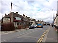
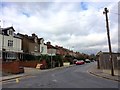
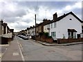
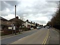
52 photos from this area
Area Information
Key information about the DA1 2XD including its size, population, and administrative classification.
- Area Type
- Postcode
- Area Size
- 4912 m²
- Population
- Not available
- Population Density
- Not available
House Prices in DA1 2XD
47
Properties
£255,100
Average Sold Price
£165,000
Lowest Price
£400,500
Highest Price
Showing 47 properties
| Address | Type | Beds | Baths | Last Sale Price | Last Sale Date | |
|---|---|---|---|---|---|---|
| 264 Phoenix Place, Dartford, DA1 2XD | Flat | 1 | 1 | £182,000 | Jul 2025 | |
| 180 Phoenix Place, Dartford, DA1 2XD | house | - | - | £325,000 | Mar 2021 | |
| 176 Phoenix Place, Dartford, DA1 2XD | house | 1 | 1 | £400,500 | Jan 2021 | |
| 230 Phoenix Place, Dartford, DA1 2XD | Flat | - | - | £165,000 | Mar 2020 | |
| 182 Phoenix Place, Dartford, DA1 2XD | house | - | - | £203,000 | Oct 2010 | |
| Royal Mail, Royal Mail Pouch Box Adjacent 194, Phoenix Place, Dartford, DA1 2XD | warehouse | - | - | - | - | |
| 234 Phoenix Place, Dartford, DA1 2XD | Flat | - | - | - | - | |
| 184 Phoenix Place, Dartford, DA1 2XD | house | - | - | - | - | |
| 188 Phoenix Place, Dartford, DA1 2XD | house | - | - | - | - | |
| 196 Phoenix Place, Dartford, DA1 2XD | Flat | - | - | - | - |
Page 1 of 5
Energy Efficiency in DA1 2XD
Amenities
Schools
| Rank | School | Type | Entry gender | Ages |
|---|
Explore more schools in this area
Go to Schools tabDemographics
Household Size
Family (3-5 people)
most common
Accommodation Type
Houses
most common
Tenure
27
majority
Ethnic Group
White
most common
Religion
N/A
most common
Household Composition
N/A
most common
Age
47
median
Adults (30-64 years)
most common
Household Deprivation
N/A
with no deprivation
NS-SEC
20
in Lower managerial occupations
Explore more demographic insights in this area
Go to Demographics tabPlanning
Planning Constraints
- Flood RiskPremium
- Ramsar Wetland SitesPremium
- Area of Outstanding Natural BeautyPremium
- Protected Nature ReservePremium
- Protected WoodlandPremium