Area Overview for DA1 2PU
Photos of DA1 2PU
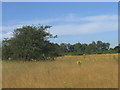
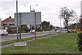

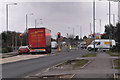
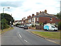
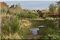

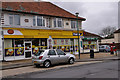
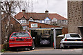
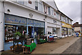

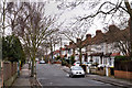
44 photos from this area
Area Information
Key information about the DA1 2PU including its size, population, and administrative classification.
- Area Type
- Postcode
- Area Size
- 13.9 hectares
- Population
- 1440
- Population Density
- 978 people/km²
House Prices in DA1 2PU
49
Properties
£316,339
Average Sold Price
£45,000
Lowest Price
£622,500
Highest Price
Showing 49 properties
| Address | Type | Beds | Baths | Last Sale Price | Last Sale Date | |
|---|---|---|---|---|---|---|
| 14 Heathclose Road, Dartford, DA1 2PU | Maisonette | 2 | 1 | £325,000 | Sep 2023 | |
| 43 Heathclose Road, Dartford, DA1 2PU | Semi-detached | 3 | 2 | £550,000 | Aug 2023 | |
| 28 Heathclose Road, Dartford, DA1 2PU | Semi-detached | 3 | 3 | £490,000 | Sep 2022 | |
| 33 Heathclose Road, Dartford, DA1 2PU | Detached | 4 | 1 | £555,000 | Jun 2021 | |
| 42 Heathclose Road, Dartford, DA1 2PU | Semi-detached | 3 | 2 | £380,000 | Jun 2021 | |
| 31 Heathclose Road, Dartford, DA1 2PU | house | - | - | £330,000 | May 2021 | |
| 36 Heathclose Road, Dartford, DA1 2PU | house | - | - | £622,500 | Apr 2021 | |
| 40 Heathclose Road, Dartford, DA1 2PU | Terraced | 2 | 1 | £332,500 | Nov 2020 | |
| 3 Heathclose Road, Dartford, DA1 2PU | house | - | - | £450,000 | Nov 2020 | |
| 26 Heathclose Road, Dartford, DA1 2PU | house | - | - | £474,500 | Jan 2020 |
Page 1 of 5
Energy Efficiency in DA1 2PU
Amenities
Schools
| Rank | School | Type | Entry gender | Ages |
|---|
Explore more schools in this area
Go to Schools tabDemographics
Household Size
Family (3-5 people)
most common
Accommodation Type
Houses
most common
Tenure
93
majority
Ethnic Group
White
most common
Religion
N/A
most common
Household Composition
N/A
most common
Age
47
median
Adults (30-64 years)
most common
Household Deprivation
N/A
with no deprivation
NS-SEC
42
in Lower managerial occupations
Explore more demographic insights in this area
Go to Demographics tabPlanning
Planning Constraints
- Flood RiskPremium
- Ramsar Wetland SitesPremium
- Area of Outstanding Natural BeautyPremium
- Protected Nature ReservePremium
- Protected WoodlandPremium