Area Overview for DA1 2PF
Photos of DA1 2PF

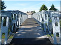
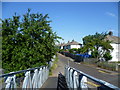
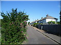
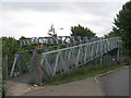
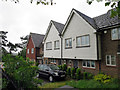

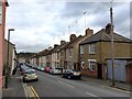
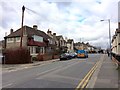
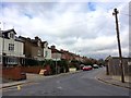
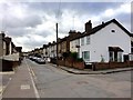
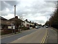
52 photos from this area
Area Information
Key information about the DA1 2PF including its size, population, and administrative classification.
- Area Type
- Postcode
- Area Size
- 2247 m²
- Population
- Not available
- Population Density
- Not available
House Prices in DA1 2PF
12
Properties
£166,354
Average Sold Price
£58,000
Lowest Price
£261,250
Highest Price
Showing 12 properties
| Address | Type | Beds | Baths | Last Sale Price | Last Sale Date | |
|---|---|---|---|---|---|---|
| 12, Heath Gardens, Heath Lane, Dartford, DA1 2PF | house | 1 | 1 | £261,250 | Oct 2022 | |
| 2, Heath Gardens, Heath Lane, Dartford, DA1 2PF | house | 1 | 1 | £245,000 | Mar 2022 | |
| 8, Heath Gardens, Heath Lane, Dartford, DA1 2PF | house | 1 | 1 | £230,000 | Nov 2021 | |
| 9, Heath Gardens, Heath Lane, Dartford, DA1 2PF | Terraced | 1 | 1 | £220,000 | Nov 2017 | |
| 3, Heath Gardens, Heath Lane, Dartford, DA1 2PF | Terraced | 1 | - | £195,000 | Jul 2017 | |
| 1, Heath Gardens, Heath Lane, Dartford, DA1 2PF | Terraced | 3 | 1 | £142,500 | Mar 2014 | |
| 11, Heath Gardens, Heath Lane, Dartford, DA1 2PF | house | - | - | £127,500 | Jul 2011 | |
| 4, Heath Gardens, Heath Lane, Dartford, DA1 2PF | house | - | - | £127,500 | Nov 2008 | |
| 5, Heath Gardens, Heath Lane, Dartford, DA1 2PF | Terraced | 1 | 1 | £140,000 | Nov 2008 | |
| 10, Heath Gardens, Heath Lane, Dartford, DA1 2PF | house | - | - | £139,500 | Nov 2006 |
Page 1 of 2
Energy Efficiency in DA1 2PF
Amenities
Schools
| Rank | School | Type | Entry gender | Ages |
|---|
Explore more schools in this area
Go to Schools tabDemographics
Household Size
Family (3-5 people)
most common
Accommodation Type
Houses
most common
Tenure
54
majority
Ethnic Group
White
most common
Religion
N/A
most common
Household Composition
N/A
most common
Age
47
median
Adults (30-64 years)
most common
Household Deprivation
N/A
with no deprivation
NS-SEC
22
in Lower managerial occupations
Explore more demographic insights in this area
Go to Demographics tabPlanning
Planning Constraints
- Flood RiskPremium
- Ramsar Wetland SitesPremium
- Area of Outstanding Natural BeautyPremium
- Protected Nature ReservePremium
- Protected WoodlandPremium