Area Overview for DA1 1ZT
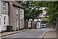
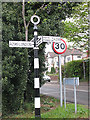
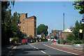
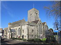
Photos of DA1 1ZT


Area Information
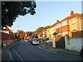
DA1 1ZT is a small, tightly knit residential postcode area within the Dartford Borough of Kent, situated near the town centre at coordinates 51.434664, 0.235696. With a population of 1915, it reflects a compact, community-focused environment. The area is part of the Brent Ward, which includes several Grade II listed buildings, such as Overy Street in New Town, Dartford. Daily life here is shaped by its proximity to essential services, including schools, rail networks, and retail hubs. The postcode area is characterised by a mix of traditional housing and modern infrastructure, offering residents a balance of historical charm and contemporary convenience. Its location near Dartford’s core means residents have easy access to town amenities, while the surrounding landscape remains largely residential, avoiding the density of larger urban centres. This makes DA1 1ZT appealing to those seeking a quieter, family-oriented environment with strong local connections.
- Area Type
- Postcode
- Area Size
- Not available
- Population
- Not available
- Population Density
- Not available
The property market in DA1 1ZT is dominated by owner-occupied homes, with 85% of residents owning their properties. This high rate of home ownership suggests a stable, long-term residential population rather than a transient rental market. The accommodation type is primarily houses, which are likely to be semi-detached or detached given the area’s small scale and residential character. This housing stock appeals to those seeking private, spacious living without the density of urban areas. Buyers in DA1 1ZT should consider the limited size of the postcode area, which may mean competition for properties. However, the proximity to Dartford’s amenities, including schools and transport links, enhances the area’s desirability. The market is likely to cater to families and professionals prioritising security and community over speculative investment.
House Prices in DA1 1ZT
No properties found in this postcode.
Energy Efficiency in DA1 1ZT
Daily life in DA1 1ZT is supported by a range of nearby amenities, including retail outlets such as Tesco Dartford E, Co-op Colney, and Iceland Dartford, ensuring easy access to groceries and everyday essentials. The area’s rail stations and ferry terminals further enhance mobility, connecting residents to Dartford’s town centre and beyond. While specific parks or leisure facilities are not detailed in the data, the presence of multiple retail and transport hubs suggests a lifestyle focused on practicality and convenience. The mix of shops and transport options allows residents to meet their needs without long commutes, fostering a self-sufficient community. The area’s small scale means amenities are closely clustered, reinforcing a sense of local cohesion.
Amenities
Schools
Residents of DA1 1ZT have access to a range of educational institutions, including York Road Junior School and Language Unit, a primary school, and York Road Junior Academy, an academy. A short distance away is Leigh Academy Dartford, an academy with an Ofsted rating of ‘good’. This mix of school types provides families with options for both early education and secondary schooling. The presence of an academy with a positive rating suggests a commitment to quality education, though specific performance data is not detailed. The proximity of these schools to the area makes DA1 1ZT attractive for families prioritising convenient access to education. The variety of school types also allows parents to choose between traditional and academically focused institutions, catering to different educational philosophies.
| Rank | School | Type | Entry gender | Ages |
|---|
Explore more schools in this area
Go to Schools tabDemographics
The population of DA1 1ZT is predominantly adults aged 30–64, with a median age of 47, indicating a mature, stable community. Home ownership is high at 85%, suggesting a long-term presence of residents who have established roots in the area. The accommodation type is largely houses, reflecting a preference for private, detached living. The predominant ethnic group is White, which aligns with broader trends in the region. This demographic profile points to a neighbourhood where families and professionals coexist, with a focus on stability and continuity. The age range suggests a mix of established households and those in their prime working years, contributing to a balanced local economy. The absence of significant deprivation data implies a relatively uniform quality of life, though specific metrics on income or social mobility are not provided.
Household Size
Accommodation Type
Tenure
Ethnic Group
Religion
Household Composition
Age
Household Deprivation
NS-SEC
Explore more demographic insights in this area
Go to Demographics tabPlanning
Planning Constraints
- Ramsar Wetland SitesPremium
- Area of Outstanding Natural BeautyPremium
- Protected Nature ReservePremium
- Protected WoodlandPremium