Area Overview for DA1 1YH
Photos of DA1 1YH
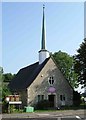
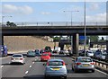
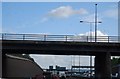
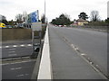

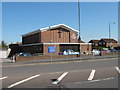
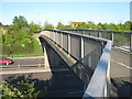
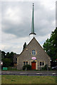
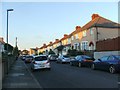
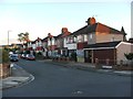
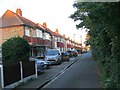
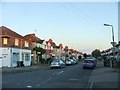
77 photos from this area
Area Information
Key information about the DA1 1YH including its size, population, and administrative classification.
- Area Type
- Postcode
- Area Size
- 8955 m²
- Population
- Not available
- Population Density
- Not available
House Prices in DA1 1YH
27
Properties
£230,500
Average Sold Price
£77,000
Lowest Price
£395,000
Highest Price
Showing 27 properties
| Address | Type | Beds | Baths | Last Sale Price | Last Sale Date | |
|---|---|---|---|---|---|---|
| 129 The Brent, Dartford, DA1 1YH | house | - | - | £262,000 | Feb 2023 | |
| 101 The Brent, Dartford, DA1 1YH | residential_space | - | - | £395,000 | Aug 2022 | |
| 107 The Brent, Dartford, DA1 1YH | Semi-detached | 3 | 1 | £360,000 | Oct 2019 | |
| 81 The Brent, Dartford, DA1 1YH | Semi-detached | 5 | 1 | £164,500 | Sep 2017 | |
| 127 The Brent, Dartford, DA1 1YH | Semi-detached | 2 | 1 | £250,000 | Sep 2017 | |
| 117 The Brent, Dartford, DA1 1YH | house | - | - | £294,000 | Dec 2015 | |
| 119 The Brent, Dartford, DA1 1YH | Semi-detached | - | - | £250,000 | Oct 2007 | |
| 99 The Brent, Dartford, DA1 1YH | Detached | - | - | £187,500 | May 2006 | |
| 111 The Brent, Dartford, DA1 1YH | Detached | 3 | 1 | £166,500 | Sep 2005 | |
| 79 The Brent, Dartford, DA1 1YH | house | - | - | £129,000 | Oct 2001 |
Page 1 of 3
Energy Efficiency in DA1 1YH
Amenities
Schools
| Rank | School | Type | Entry gender | Ages |
|---|
Explore more schools in this area
Go to Schools tabDemographics
Household Size
Family (3-5 people)
most common
Accommodation Type
Houses
most common
Tenure
77
majority
Ethnic Group
White
most common
Religion
N/A
most common
Household Composition
N/A
most common
Age
47
median
Adults (30-64 years)
most common
Household Deprivation
N/A
with no deprivation
NS-SEC
32
in Lower managerial occupations
Explore more demographic insights in this area
Go to Demographics tabPlanning
Planning Constraints
- Flood RiskPremium
- Ramsar Wetland SitesPremium
- Area of Outstanding Natural BeautyPremium
- Protected Nature ReservePremium
- Protected WoodlandPremium