Area Overview for DA1 1UH
Photos of DA1 1UH
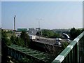
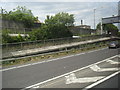
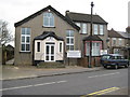
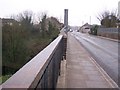

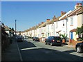
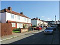
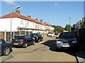
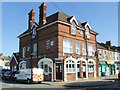
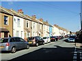
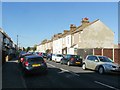
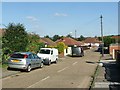
53 photos from this area
Area Information
Key information about the DA1 1UH including its size, population, and administrative classification.
- Area Type
- Postcode
- Area Size
- 1.4 hectares
- Population
- 2059
- Population Density
- 10020 people/km²
House Prices in DA1 1UH
55
Properties
£208,889
Average Sold Price
£15,000
Lowest Price
£424,500
Highest Price
Showing 55 properties
| Address | Type | Beds | Baths | Last Sale Price | Last Sale Date | |
|---|---|---|---|---|---|---|
| 92 Colney Road, Dartford, DA1 1UH | Semi-detached | 3 | 1 | £368,000 | Sep 2024 | |
| 88 Colney Road, Dartford, DA1 1UH | Maisonette | 2 | 2 | £251,000 | May 2023 | |
| 142 Colney Road, Dartford, DA1 1UH | Terraced | 3 | - | £424,500 | Jun 2022 | |
| 80 Colney Road, Dartford, DA1 1UH | house | 2 | 1 | £340,000 | May 2022 | |
| 64 Colney Road, Dartford, DA1 1UH | Terraced | 3 | - | £355,000 | Nov 2021 | |
| 78 Colney Road, Dartford, DA1 1UH | house | - | - | £270,000 | Apr 2021 | |
| 122 Colney Road, Dartford, DA1 1UH | house | - | - | £355,000 | Mar 2021 | |
| 134 Colney Road, Dartford, DA1 1UH | Terraced | 3 | 1 | £345,000 | Oct 2020 | |
| 156 Colney Road, Dartford, DA1 1UH | Terraced | 2 | 1 | £283,000 | Jul 2019 | |
| 72 Colney Road, Dartford, DA1 1UH | Terraced | 4 | 2 | £345,000 | May 2019 |
Page 1 of 6
Energy Efficiency in DA1 1UH
Amenities
Schools
| Rank | School | Type | Entry gender | Ages |
|---|
Explore more schools in this area
Go to Schools tabDemographics
Household Size
Family (3-5 people)
most common
Accommodation Type
Houses
most common
Tenure
67
majority
Ethnic Group
White
most common
Religion
N/A
most common
Household Composition
N/A
most common
Age
47
median
Adults (30-64 years)
most common
Household Deprivation
N/A
with no deprivation
NS-SEC
31
in Lower managerial occupations
Explore more demographic insights in this area
Go to Demographics tabPlanning
Planning Constraints
- Flood RiskPremium
- Ramsar Wetland SitesPremium
- Area of Outstanding Natural BeautyPremium
- Protected Nature ReservePremium
- Protected WoodlandPremium