Area Overview for CT9 5WB
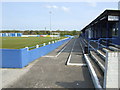
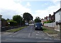
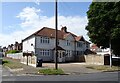
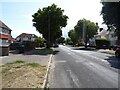
Photos of CT9 5WB

Area Information
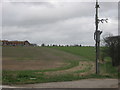
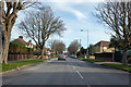
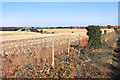
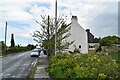
CT9 5WB is a small, densely populated residential cluster within the village of Garlinge, a suburb of Margate in Kent. With 1,483 residents squeezed into a compact area, the postcode reflects a suburban character shaped by its history as a 19th-century commuter hub. Garlinge’s name traces back to Garling’s Farm, once owned by London hospitals, and the area developed alongside Margate’s railway and seaside tourism boom. Today, it functions as a residential extension of Margate, with a population density of 1,482 people per square kilometre. The median age of 47 suggests a community of settled adults, many likely tied to nearby employment or retirement. While the area lacks commercial vibrancy, its proximity to Margate’s amenities and transport links makes it a practical choice for those seeking a quieter, family-oriented environment amid the broader Thanet district.
- Area Type
- Postcode
- Area Size
- Not available
- Population
- 1483
- Population Density
- 1482 people/km²
CT9 5WB is a predominantly owner-occupied area, with 52% of homes owned by residents rather than rented. The accommodation type is exclusively houses, which is unusual for a small postcode area but aligns with Garlinge’s suburban character. This suggests a housing stock suited to families or individuals seeking space, though the high population density indicates limited land availability. The small size of the area means the property market is likely constrained, with competition for homes among local residents. Buyers should consider the proximity to Margate’s amenities and transport links, which may offset the area’s compact footprint. The focus on houses also implies a lower density of rental properties, potentially limiting options for those seeking short-term or flexible housing.
House Prices in CT9 5WB
No properties found in this postcode.
Energy Efficiency in CT9 5WB
The lifestyle in CT9 5WB is defined by proximity to Margate’s amenities and historical sites. Nearby shops include Tesco Margate, M&S Garlinge Margate BP, and Iceland Margate, offering daily essentials. The area’s character is shaped by its heritage, with landmarks like All Saints Church and the Dent-de-Lion gateway, a grade II* listed medieval structure. While the postcode itself lacks parks or leisure facilities, residents can access Margate’s beaches, promenades, and cultural venues. The rail links to Westgate and Birchington provide access to broader leisure options, while the ferry terminal connects to Ramsgate. This blend of practicality and historical charm suits those seeking a quiet, connected suburban life.
Amenities
Schools
CT9 5WB is served by a range of primary schools, including Garlinge Junior School, Garlinge Infant School, Garlinge Primary School and Nursery (rated ‘good’ by Ofsted), and Hartsdown Technology College. Hartsdown Academy, an academy rated ‘good’, adds secondary education options. The mix of primary and academy schools provides a continuum of education, though no secondary schools are explicitly listed. For families, the ‘good’ Ofsted ratings indicate satisfactory performance, but the absence of data on exam results or pupil outcomes means further research is needed. The concentration of primary schools suggests a community prioritising local schooling, though the lack of secondary options may require commuting to Margate or Ramsgate.
| Rank | School | Type | Entry gender | Ages |
|---|---|---|---|---|
| 1 | Garlinge Junior School | primary | N/A | N/A |
| 2 | Garlinge Infant School | primary | N/A | N/A |
| 3 | Hartsdown Technology College | primary | N/A | N/A |
| 4 | Garlinge Primary School and Nursery | primary | N/A | N/A |
| 5 | Hartsdown Academy | academy | N/A | N/A |
Explore more schools in this area
Go to Schools tabDemographics
The population of CT9 5WB is predominantly adults aged 30-64, reflecting a mature demographic with a median age of 47. Home ownership sits at 52%, indicating a mix of owner-occupied properties and rental units. The accommodation type is primarily houses, suggesting a focus on family homes rather than apartments. The predominant ethnic group is White, with no data provided on other ethnicities. This demographic profile points to a stable, long-term community with limited diversity. The absence of specific data on deprivation or socioeconomic breakdown means the area’s quality of life can only be inferred from its infrastructure and services. The high home ownership rate and age range imply a population likely focused on established careers and retirement, with limited turnover.
Household Size
Accommodation Type
Tenure
Ethnic Group
Religion
Household Composition
Age
Household Deprivation
NS-SEC
Explore more demographic insights in this area
Go to Demographics tabPlanning
Planning Constraints
- Flood RiskPremium
- Ramsar Wetland SitesPremium
- Area of Outstanding Natural BeautyPremium
- Protected Nature ReservePremium
- Protected WoodlandPremium
- Crime RiskPremium