Area Overview for CT9 5WA
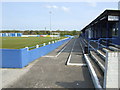
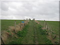
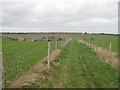
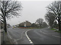
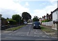
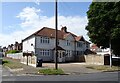
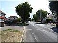
Photos of CT9 5WA

Area Information
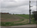
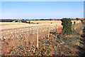
Living in CT9 5WA means being part of a small, densely populated residential cluster in the Isle of Thanet, just 2 miles from Margate’s centre. With a population of 1,483 and a density of 1,482 people per square kilometre, this area reflects a compact suburban character shaped by its history as a Victorian-era commuter hub. Garlinge, the village at its heart, developed alongside Margate’s railway and seaside tourism, merging into the wider Margate conurbation. Daily life here balances suburban tranquillity with proximity to urban amenities. Residents benefit from nearby schools, retail outlets, and transport links, while the area’s compact size ensures a tight-knit community feel. The postcode’s location on the Isle of Thanet also offers coastal access, though the area itself is defined more by its residential and commuter functions than by tourism. For those seeking a mix of convenience and historical context, CT9 5WA provides a snapshot of Thanet’s evolving identity.
- Area Type
- Postcode
- Area Size
- Not available
- Population
- 1483
- Population Density
- 1482 people/km²
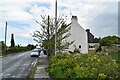
The property market in CT9 5WA is characterised by a 52% home ownership rate, with houses being the predominant accommodation type. This suggests a mix of owner-occupied properties and rental stock, though the exact balance of rentals is not specified. The presence of houses rather than flats or apartments indicates a more traditional, family-oriented housing stock, potentially with larger living spaces. Given the area’s small size and high population density, the market is likely constrained by limited land availability, making it a niche area for buyers seeking suburban living within Margate’s reach. Proximity to transport links and schools may enhance its appeal, but the compact nature of the postcode means buyers should consider nearby suburbs for broader options. The market’s stability is likely influenced by its established demographic profile and historical development as a commuter zone.
House Prices in CT9 5WA
No properties found in this postcode.
Energy Efficiency in CT9 5WA
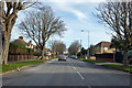
Daily life in CT9 5WA is shaped by its proximity to retail, transport, and coastal access. The area’s five retail outlets include major names like Tesco Margate and Iceland Margate, providing essentials and groceries. Rail stations such as Margate and Birchington offer frequent services to London and other Kent towns, while the Ramsgate Ferry Terminal connects to the mainland. Kent International Airport is a short drive away, adding to the area’s appeal for frequent travellers. The suburban character of CT9 5WA means it lacks large parks or leisure facilities, but its location within Margate’s conurbation ensures access to broader amenities. The mix of local shops, transport links, and coastal proximity creates a lifestyle that balances convenience with the constraints of a small postcode.
Amenities
Schools
Residents of CT9 5WA have access to a range of primary and secondary education options. Garlinge Junior and Infant Schools, along with Garlinge Primary School and Nursery, provide early years to primary education, with the latter holding a ‘good’ Ofsted rating. Hartsdown Technology College and Hartsdown Academy cater to secondary education, though the latter is an academy with a ‘good’ rating. The mix of primary and academy schools offers families a choice of institutions, though secondary options are limited to a single academy. The absence of independent or specialist schools may be a consideration for parents seeking specific educational pathways. The quality of primary education is reassuring, but the secondary provision is narrow, requiring families to travel to broader Margate or Thanet areas for alternative options.
| Rank | School | Type | Entry gender | Ages |
|---|---|---|---|---|
| 1 | Garlinge Junior School | primary | N/A | N/A |
| 2 | Garlinge Infant School | primary | N/A | N/A |
| 3 | Hartsdown Technology College | primary | N/A | N/A |
| 4 | Garlinge Primary School and Nursery | primary | N/A | N/A |
| 5 | Hartsdown Academy | academy | N/A | N/A |
Explore more schools in this area
Go to Schools tabDemographics
The community in CT9 5WA skews towards middle-aged residents, with a median age of 47 and the most common age range being 30–64 years. This suggests a population largely composed of working-age adults and families, with fewer younger or elderly residents. Home ownership here is modest at 52%, indicating a mix of owner-occupied properties and rental homes. The accommodation type is predominantly houses, which is unusual for a densely populated area, hinting at a blend of larger homes and semi-detached housing. The predominant ethnic group is White, though specific diversity data is not provided. The age profile and ownership figures suggest a stable, established community with limited generational turnover. For those considering relocation, this demographic profile may indicate a mature, low-volatility housing market with a focus on long-term residency rather than transient populations.
Household Size
Accommodation Type
Tenure
Ethnic Group
Religion
Household Composition
Age
Household Deprivation
NS-SEC
Explore more demographic insights in this area
Go to Demographics tabPlanning
Planning Constraints
- Flood RiskPremium
- Ramsar Wetland SitesPremium
- Area of Outstanding Natural BeautyPremium
- Protected Nature ReservePremium
- Protected WoodlandPremium
- Crime RiskPremium